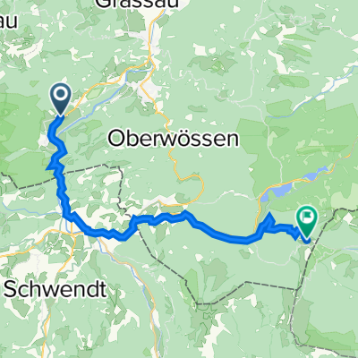
12.10.11 Schmugglerweg bei Schleching
A cycling route starting in Schleching, Bavaria, Germany.
Overview
About this route
Gemütliche Wanderung auf überwiegend gutem Weg mit netter Einkehr am Klobenstein.
- -:--
- Duration
- 8.4 km
- Distance
- 480 m
- Ascent
- 480 m
- Descent
- ---
- Avg. speed
- ---
- Avg. speed
Route highlights
Points of interest along the route
Photo after 3.7 km
Photo after 3.7 km
Blick auf Klobenstein
Point of interest after 4.3 km
Kapelle
Accommodation after 4.4 km
Gasthaus
Photo after 4.5 km
Klammbrücke
Photo after 5.9 km
Feuersalamander
Continue with Bikemap
Use, edit, or download this cycling route
You would like to ride 12.10.11 Schmugglerweg bei Schleching or customize it for your own trip? Here is what you can do with this Bikemap route:
Free features
- Save this route as favorite or in collections
- Copy & plan your own version of this route
- Sync your route with Garmin or Wahoo
Premium features
Free trial for 3 days, or one-time payment. More about Bikemap Premium.
- Navigate this route on iOS & Android
- Export a GPX / KML file of this route
- Create your custom printout (try it for free)
- Download this route for offline navigation
Discover more Premium features.
Get Bikemap PremiumFrom our community
Other popular routes starting in Schleching
- campingp. grasau
- Distance
- 23.4 km
- Ascent
- 276 m
- Descent
- 285 m
- Location
- Schleching, Bavaria, Germany
- Jochbergalm von Zellersee aus
- Distance
- 23.6 km
- Ascent
- 812 m
- Descent
- 812 m
- Location
- Schleching, Bavaria, Germany
- Südliche Kampenwandrunde mit Sonnen- und Oberauerbrunstalm
- Distance
- 22.6 km
- Ascent
- 1,256 m
- Descent
- 1,255 m
- Location
- Schleching, Bavaria, Germany
- Schleching Winklmoosalm
- Distance
- 25.6 km
- Ascent
- 1,102 m
- Descent
- 514 m
- Location
- Schleching, Bavaria, Germany
- 12.10.11 Schmugglerweg bei Schleching
- Distance
- 8.4 km
- Ascent
- 480 m
- Descent
- 480 m
- Location
- Schleching, Bavaria, Germany
- Parkplatz Taubensee Hinterwössen Kanonenpass
- Distance
- 41.1 km
- Ascent
- 1,665 m
- Descent
- 1,667 m
- Location
- Schleching, Bavaria, Germany
- Zellerseeweg 3, Schleching to Reit im Winkl
- Distance
- 22.2 km
- Ascent
- 1,114 m
- Descent
- 879 m
- Location
- Schleching, Bavaria, Germany
- Geigelstein von Ettenhausen aus
- Distance
- 10.5 km
- Ascent
- 820 m
- Descent
- 808 m
- Location
- Schleching, Bavaria, Germany
Open it in the app