
Cappucino Tour Würzbach Schömberg Kleinenzhof Simmersfeld
A cycling route starting in Simmersfeld, Baden-Wurttemberg, Germany.
Overview
About this route
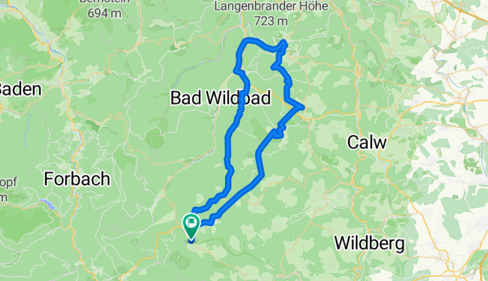
We start our tour in Simmersfeld at the Cleanpark Dinkel (there are also sufficient parking spaces available here). From Simmersfeld we go over Oberweiler, Aichhalden, Hofstett and Agenbach to Würzbach.
At the Hölzle gas station we turn left towards the sports field. We continue along the gravel path towards Oberreichenbach, where we cross the federal road. On the signposted path, we ride until Schömberg. At the roundabout, we turn towards Höfen and race down the road. In Höfen, we cross the B 294 and ride on the right side towards the valley.
At the Kleinenzhof campsite, we take a short break, have a cup of coffee and eat a piece of Black Forest cherry cake. So replenished, the continuation towards Simmersfeld isn't too difficult for us. After about 60 km we arrived tired and a bit exhausted at the parking lot in Simmersfeld.
It was nice.
- -:--
- Duration
- 59.7 km
- Distance
- 647 m
- Ascent
- 647 m
- Descent
- ---
- Avg. speed
- ---
- Max. altitude
Route quality
Waytypes & surfaces along the route
Waytypes
Track
35.2 km
(59 %)
Quiet road
7.8 km
(13 %)
Surfaces
Paved
22.1 km
(37 %)
Unpaved
29.3 km
(49 %)
Gravel
24.5 km
(41 %)
Asphalt
19.1 km
(32 %)
Continue with Bikemap
Use, edit, or download this cycling route
You would like to ride Cappucino Tour Würzbach Schömberg Kleinenzhof Simmersfeld or customize it for your own trip? Here is what you can do with this Bikemap route:
Free features
- Save this route as favorite or in collections
- Copy & plan your own version of this route
- Sync your route with Garmin or Wahoo
Premium features
Free trial for 3 days, or one-time payment. More about Bikemap Premium.
- Navigate this route on iOS & Android
- Export a GPX / KML file of this route
- Create your custom printout (try it for free)
- Download this route for offline navigation
Discover more Premium features.
Get Bikemap PremiumFrom our community
Other popular routes starting in Simmersfeld
 rwgps-ebhausen110
- Distance
- 110.3 km
- Ascent
- 1,595 m
- Descent
- 1,594 m
- Location
- Simmersfeld, Baden-Wurttemberg, Germany
 Oberweiler - Mötzingen
- Distance
- 35.2 km
- Ascent
- 373 m
- Descent
- 652 m
- Location
- Simmersfeld, Baden-Wurttemberg, Germany
 Simmersfeld - Meersburg - Singen
- Distance
- 253.7 km
- Ascent
- 1,040 m
- Descent
- 1,359 m
- Location
- Simmersfeld, Baden-Wurttemberg, Germany
 baden-baden110
- Distance
- 110.9 km
- Ascent
- 2,097 m
- Descent
- 2,096 m
- Location
- Simmersfeld, Baden-Wurttemberg, Germany
 Besenfeld - Freudenstadt- Wolfach - Mühlenbach (Blackforest 2)
- Distance
- 76.2 km
- Ascent
- 554 m
- Descent
- 1,082 m
- Location
- Simmersfeld, Baden-Wurttemberg, Germany
 Nagoldtalradweg - Urnagold - (Calw) Pforzheim
- Distance
- 125.4 km
- Ascent
- 2,242 m
- Descent
- 2,468 m
- Location
- Simmersfeld, Baden-Wurttemberg, Germany
 Nagold Enz
- Distance
- 99.4 km
- Ascent
- 91 m
- Descent
- 655 m
- Location
- Simmersfeld, Baden-Wurttemberg, Germany
 Forstweg nach Straße Ohne Straßennamen
- Distance
- 22.8 km
- Ascent
- 332 m
- Descent
- 259 m
- Location
- Simmersfeld, Baden-Wurttemberg, Germany
Open it in the app