

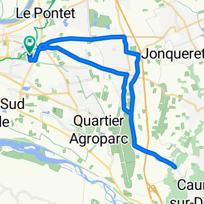
2012 French Tour -- Ride Day 53 -- 15 October 2012 -- Le Pontet (Avignon) to St-Jean-du-Gard
A cycling route starting in Le Pontet, Provence-Alpes-Côte d'Azur Region, France.
Overview
About this route
To be added later...
Today we returned to a Logis de France hotel in St-Jean-du-Gard that we had patronized during two previous cycling tours in 2004 and 2005. Happily, the same owner-chef is still there (though slightly older looking...as are we) and his food is still just as wonderful as we remember. It's the Auberge du Peras and we do recommend it.
Overall, a great but tiring ride today on mostly excellent roads. Very tiring due to gale-force headwinds that made us have to fight on every pedal stroke.
D101 west of St-Laurent-des-Arbres and first portion of D982 until nearing Uzès was particularly nice low-traffic riding. Much of the rest of D982 was excellent road, but less traffic would have made it much better. The D8/D907 approach to Anduze I'm sure was much better than whatever route the traffic signs for cars was directing. <div><br /></div>
- -:--
- Duration
- 112.1 km
- Distance
- 560 m
- Ascent
- 403 m
- Descent
- ---
- Avg. speed
- ---
- Max. altitude

Route quality
Waytypes & surfaces along the route
Waytypes
Road
17.9 km
(16 %)
Quiet road
11.2 km
(10 %)
Surfaces
Paved
49.3 km
(44 %)
Unpaved
1.1 km
(1 %)
Asphalt
49.3 km
(44 %)
Gravel
1.1 km
(1 %)
Undefined
61.6 km
(55 %)
Continue with Bikemap
Use, edit, or download this cycling route
You would like to ride 2012 French Tour -- Ride Day 53 -- 15 October 2012 -- Le Pontet (Avignon) to St-Jean-du-Gard or customize it for your own trip? Here is what you can do with this Bikemap route:
Free features
- Save this route as favorite or in collections
- Copy & plan your own version of this route
- Split it into stages to create a multi-day tour
- Sync your route with Garmin or Wahoo
Premium features
Free trial for 3 days, or one-time payment. More about Bikemap Premium.
- Navigate this route on iOS & Android
- Export a GPX / KML file of this route
- Create your custom printout (try it for free)
- Download this route for offline navigation
Discover more Premium features.
Get Bikemap PremiumFrom our community
Other popular routes starting in Le Pontet
 2012 French Tour -- Ride Day 53 -- 15 October 2012 -- Le Pontet (Avignon) to St-Jean-du-Gard
- Distance
- 112.1 km
- Ascent
- 560 m
- Descent
- 403 m
- Location
- Le Pontet, Provence-Alpes-Côte d'Azur Region, France
 avignon sault
- Distance
- 59.9 km
- Ascent
- 1,081 m
- Descent
- 395 m
- Location
- Le Pontet, Provence-Alpes-Côte d'Azur Region, France
 De 45 Rue Charles Chartier, Avignon à 45 Rue Charles Chartier, Avignon
- Distance
- 22.5 km
- Ascent
- 153 m
- Descent
- 152 m
- Location
- Le Pontet, Provence-Alpes-Côte d'Azur Region, France
 hghgh
hghgh- Distance
- 2.1 km
- Ascent
- 4 m
- Descent
- 5 m
- Location
- Le Pontet, Provence-Alpes-Côte d'Azur Region, France
 Avignon-Rousillion (59)
- Distance
- 50.8 km
- Ascent
- 504 m
- Descent
- 296 m
- Location
- Le Pontet, Provence-Alpes-Côte d'Azur Region, France
 110 km Monts de Vaucluse Le Pontet Murs Lioux Saint Lambert Indochinois Méthamis Malemort Pernes
- Distance
- 109.7 km
- Ascent
- 1,204 m
- Descent
- 1,204 m
- Location
- Le Pontet, Provence-Alpes-Côte d'Azur Region, France
 Tag 7 - Rückgabe Auto Europcar
- Distance
- 12.2 km
- Ascent
- 11 m
- Descent
- 18 m
- Location
- Le Pontet, Provence-Alpes-Côte d'Azur Region, France
 De 45 Rue Charles Chartier, Avignon à 45 Rue Charles Chartier, Avignon
- Distance
- 69.3 km
- Ascent
- 11 m
- Descent
- 27 m
- Location
- Le Pontet, Provence-Alpes-Côte d'Azur Region, France
Open it in the app