

Fietsen door de Jura
A cycling route starting in Laufen, Basel-Landschaft, Switzerland.
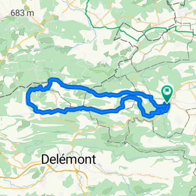
Overview
About this route
This cycling route goes along bike paths, country lanes, and gravel roads. Occasionally crossing through meadows over the Jura mountains. An area where it seems only Swiss go on holiday. Camping by a stream or at a fire pit. No snow-white mountains or wooden chalets with geraniums. But forested mountains with simple villages. You don’t hear cars speeding by. You hear the rustling of grass, woodpeckers knocking on trees, birds singing. At least if you don’t hear yourself panting…
- -:--
- Duration
- 285.1 km
- Distance
- 3,013 m
- Ascent
- 2,984 m
- Descent
- ---
- Avg. speed
- ---
- Max. altitude

Route quality
Waytypes & surfaces along the route
Waytypes
Quiet road
77 km
(27 %)
Road
71.3 km
(25 %)
Surfaces
Paved
122.6 km
(43 %)
Unpaved
37.1 km
(13 %)
Asphalt
108.3 km
(38 %)
Gravel
22.8 km
(8 %)
Route highlights
Points of interest along the route
Point of interest after 0 km
Basel
Accommodation after 0 km
Camping Rank
Accommodation after 32.3 km
Camping La Grande Ecluse
Accommodation after 71.9 km
Camping Saignelégier
Accommodation after 106.9 km
Camping La Cibourg
Accommodation after 145.1 km
Camping La Belle Verte
Accommodation after 180.4 km
Camping Val de Travers
Accommodation after 232.4 km
Camping Pré Sous Ville
Accommodation after 248.9 km
Camping du Rocheray
Point of interest after 285.1 km
Meer van Geneve
Accommodation after 285.1 km
Camping Rolle
Continue with Bikemap
Use, edit, or download this cycling route
You would like to ride Fietsen door de Jura or customize it for your own trip? Here is what you can do with this Bikemap route:
Free features
- Save this route as favorite or in collections
- Copy & plan your own version of this route
- Split it into stages to create a multi-day tour
- Sync your route with Garmin or Wahoo
Premium features
Free trial for 3 days, or one-time payment. More about Bikemap Premium.
- Navigate this route on iOS & Android
- Export a GPX / KML file of this route
- Create your custom printout (try it for free)
- Download this route for offline navigation
Discover more Premium features.
Get Bikemap PremiumFrom our community
Other popular routes starting in Laufen
 Huggerwald
- Distance
- 18.6 km
- Ascent
- 489 m
- Descent
- 491 m
- Location
- Laufen, Basel-Landschaft, Switzerland
 Gemütliche Route in Laufen
- Distance
- 28.3 km
- Ascent
- 550 m
- Descent
- 553 m
- Location
- Laufen, Basel-Landschaft, Switzerland
 Easy1
Easy1- Distance
- 27.1 km
- Ascent
- 672 m
- Descent
- 677 m
- Location
- Laufen, Basel-Landschaft, Switzerland
 Laufen - Röschenz - Dittinger Flugfeld - Laufen
- Distance
- 10.7 km
- Ascent
- 238 m
- Descent
- 238 m
- Location
- Laufen, Basel-Landschaft, Switzerland
 Fietsen door de Jura
- Distance
- 285.1 km
- Ascent
- 3,013 m
- Descent
- 2,984 m
- Location
- Laufen, Basel-Landschaft, Switzerland
 14.01.2020 Sportliche Route in Laufen - March
- Distance
- 30.6 km
- Ascent
- 373 m
- Descent
- 373 m
- Location
- Laufen, Basel-Landschaft, Switzerland
 19.01.2020 Huggerwald
- Distance
- 18.3 km
- Ascent
- 321 m
- Descent
- 320 m
- Location
- Laufen, Basel-Landschaft, Switzerland
 Laufen-Löwenburg
- Distance
- 42.1 km
- Ascent
- 641 m
- Descent
- 640 m
- Location
- Laufen, Basel-Landschaft, Switzerland
Open it in the app