

Kahl am Main
A cycling route starting in Gelnhausen, Hesse, Germany.
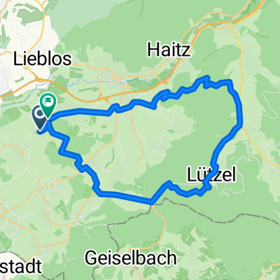
Overview
About this route
MTB 16.05.2009
Start and finish:DAV climbing tower in Gelnhausen
Route via:Langenselbold - Niederrodenbach - Kahl am Main - Alzenau - Michelbach - Bernbach - Großenhausen
- -:--
- Duration
- 55.8 km
- Distance
- 150 m
- Ascent
- 118 m
- Descent
- ---
- Avg. speed
- 163 m
- Max. altitude
Route quality
Waytypes & surfaces along the route
Waytypes
Track
21.2 km
(38 %)
Quiet road
13.4 km
(24 %)
Surfaces
Paved
43 km
(77 %)
Unpaved
6.1 km
(11 %)
Asphalt
40.2 km
(72 %)
Gravel
5 km
(9 %)
Continue with Bikemap
Use, edit, or download this cycling route
You would like to ride Kahl am Main or customize it for your own trip? Here is what you can do with this Bikemap route:
Free features
- Save this route as favorite or in collections
- Copy & plan your own version of this route
- Sync your route with Garmin or Wahoo
Premium features
Free trial for 3 days, or one-time payment. More about Bikemap Premium.
- Navigate this route on iOS & Android
- Export a GPX / KML file of this route
- Create your custom printout (try it for free)
- Download this route for offline navigation
Discover more Premium features.
Get Bikemap PremiumFrom our community
Other popular routes starting in Gelnhausen
 Kleine Spessartrunde
- Distance
- 30.1 km
- Ascent
- 480 m
- Descent
- 469 m
- Location
- Gelnhausen, Hesse, Germany
 Abendrunde Freigericht
- Distance
- 25.5 km
- Ascent
- 105 m
- Descent
- 106 m
- Location
- Gelnhausen, Hesse, Germany
 Flachetappe Aufenauer Höhe
- Distance
- 30.5 km
- Ascent
- 202 m
- Descent
- 201 m
- Location
- Gelnhausen, Hesse, Germany
 Lieblos-Hammersbach Trainingsrunde
- Distance
- 52 km
- Ascent
- 344 m
- Descent
- 357 m
- Location
- Gelnhausen, Hesse, Germany
 Wiebüttsee.gpx
- Distance
- 50.1 km
- Ascent
- 579 m
- Descent
- 585 m
- Location
- Gelnhausen, Hesse, Germany
 Spessart*20*36km+1041hm
- Distance
- 35.4 km
- Ascent
- 768 m
- Descent
- 771 m
- Location
- Gelnhausen, Hesse, Germany
 Alzenau-Kahl-Rodenbach
- Distance
- 47.1 km
- Ascent
- 283 m
- Descent
- 279 m
- Location
- Gelnhausen, Hesse, Germany
 Lützel-Runde
- Distance
- 24.8 km
- Ascent
- 337 m
- Descent
- 337 m
- Location
- Gelnhausen, Hesse, Germany
Open it in the app