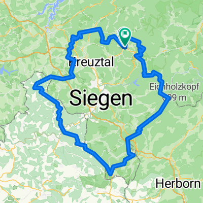
Hilchenbach Panoramaweg.
A cycling route starting in Hilchenbach, North Rhine-Westphalia, Germany.
Overview
About this route
Really beautiful route. Almost no asphalt, just gravel roads, forest highways, and the occasional narrow path. Short sections are blocked by roots.
There are some great panoramic views to enjoy. Really awesome!
Please excuse that the route takes so long to load, the GPX file comes from my GPS device - a marker every 5 seconds. But it is also very accurate. :)
- -:--
- Duration
- 30.7 km
- Distance
- 555 m
- Ascent
- 555 m
- Descent
- ---
- Avg. speed
- ---
- Max. altitude
Route quality
Waytypes & surfaces along the route
Waytypes
Track
25.8 km
(84 %)
Quiet road
3.1 km
(10 %)
Surfaces
Paved
7.4 km
(24 %)
Unpaved
20.9 km
(68 %)
Gravel
14.4 km
(47 %)
Asphalt
5.8 km
(19 %)
Route highlights
Points of interest along the route
Point of interest after 6.8 km
Point of interest after 9.6 km
Giller. Hier ist man "oben" hab ich gelernt. ;)
Point of interest after 12.8 km
Ferndorfquelle
Point of interest after 14.1 km
Point of interest after 14.6 km
Point of interest after 15.8 km
Windräder. Ein neues "oben"
Point of interest after 21 km
Point of interest after 21.5 km
Point of interest after 29.1 km
Breitenbachtalsperre
Continue with Bikemap
Use, edit, or download this cycling route
You would like to ride Hilchenbach Panoramaweg. or customize it for your own trip? Here is what you can do with this Bikemap route:
Free features
- Save this route as favorite or in collections
- Copy & plan your own version of this route
- Sync your route with Garmin or Wahoo
Premium features
Free trial for 3 days, or one-time payment. More about Bikemap Premium.
- Navigate this route on iOS & Android
- Export a GPX / KML file of this route
- Create your custom printout (try it for free)
- Download this route for offline navigation
Discover more Premium features.
Get Bikemap PremiumFrom our community
Other popular routes starting in Hilchenbach
- LAHN Radweg
- Distance
- 261.7 km
- Ascent
- 309 m
- Descent
- 790 m
- Location
- Hilchenbach, North Rhine-Westphalia, Germany
- Lahn-Radweg
- Distance
- 268.2 km
- Ascent
- 210 m
- Descent
- 697 m
- Location
- Hilchenbach, North Rhine-Westphalia, Germany
- Ederauen-Radweg (1)
- Distance
- 62.8 km
- Ascent
- 231 m
- Descent
- 461 m
- Location
- Hilchenbach, North Rhine-Westphalia, Germany
- Ederkopf über Bad Berleburg nach Hemfurth
- Distance
- 143.7 km
- Ascent
- 344 m
- Descent
- 703 m
- Location
- Hilchenbach, North Rhine-Westphalia, Germany
- Breitenbachtalsperre über Kreuztal und Siegen nach Dreißig-Tiefenbach
- Distance
- 24.3 km
- Ascent
- 296 m
- Descent
- 357 m
- Location
- Hilchenbach, North Rhine-Westphalia, Germany
- deko: Runde Dahlbruch Rhein-Weser Turm
- Distance
- 46.1 km
- Ascent
- 784 m
- Descent
- 785 m
- Location
- Hilchenbach, North Rhine-Westphalia, Germany
- Lahntal Radweg - Tag1
- Distance
- 67.8 km
- Ascent
- 264 m
- Descent
- 625 m
- Location
- Hilchenbach, North Rhine-Westphalia, Germany
- Hilchenbach Panoramaweg.
- Distance
- 30.7 km
- Ascent
- 555 m
- Descent
- 555 m
- Location
- Hilchenbach, North Rhine-Westphalia, Germany
Open it in the app