

Trasa dla osób lubiących nocne wyprawy po oświetlonych drogach.
A cycling route starting in Stalowa Wola, Subcarpathian Voivodeship, Poland.
Overview
About this route
Trasa doskonale oświetlona, przydatna dla chcących spalić kalorie po wieczornej kolacji.
Można po niej: jaździć i biegać.
Do zobaczenia podczas eksploracji trasy :)
- -:--
- Duration
- 9.5 km
- Distance
- 47 m
- Ascent
- 47 m
- Descent
- ---
- Avg. speed
- ---
- Max. altitude

Route quality
Waytypes & surfaces along the route
Waytypes
Cycleway
7.7 km
(81 %)
Road
0.9 km
(9 %)
Surfaces
Paved
2.5 km
(26 %)
Asphalt
2 km
(21 %)
Paved (undefined)
0.5 km
(5 %)
Undefined
7 km
(74 %)
Continue with Bikemap
Use, edit, or download this cycling route
You would like to ride Trasa dla osób lubiących nocne wyprawy po oświetlonych drogach. or customize it for your own trip? Here is what you can do with this Bikemap route:
Free features
- Save this route as favorite or in collections
- Copy & plan your own version of this route
- Sync your route with Garmin or Wahoo
Premium features
Free trial for 3 days, or one-time payment. More about Bikemap Premium.
- Navigate this route on iOS & Android
- Export a GPX / KML file of this route
- Create your custom printout (try it for free)
- Download this route for offline navigation
Discover more Premium features.
Get Bikemap PremiumFrom our community
Other popular routes starting in Stalowa Wola
 104 (28/16) Stalowa Wola-Bojanów-Brzóza Król.-Żołynia-Mikulice-Kańczuga
- Distance
- 103.7 km
- Ascent
- 255 m
- Descent
- 218 m
- Location
- Stalowa Wola, Subcarpathian Voivodeship, Poland
 Łącznik Greenvelo przez Lasy Państwowe
- Distance
- 12.7 km
- Ascent
- 33 m
- Descent
- 30 m
- Location
- Stalowa Wola, Subcarpathian Voivodeship, Poland
 Wyśmienita i wszechstronna trasa na wierczorne: bieganie/jazdę na rolkach/jazdę na rowerze.
- Distance
- 6.4 km
- Ascent
- 24 m
- Descent
- 26 m
- Location
- Stalowa Wola, Subcarpathian Voivodeship, Poland
 Stalowa Wola do I Paderewskiego, Przemyśl
- Distance
- 122.8 km
- Ascent
- 877 m
- Descent
- 771 m
- Location
- Stalowa Wola, Subcarpathian Voivodeship, Poland
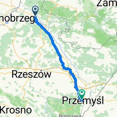
 From Stalowa Wola to Przemyśl
- Distance
- 124.4 km
- Ascent
- 736 m
- Descent
- 623 m
- Location
- Stalowa Wola, Subcarpathian Voivodeship, Poland
 Rowerowa trasa do PxM 2011/2012
- Distance
- 44.8 km
- Ascent
- 57 m
- Descent
- 57 m
- Location
- Stalowa Wola, Subcarpathian Voivodeship, Poland
 Aleje Jana Pawła II 13A, Stalowa Wola do Aleje Jana Pawła II 13A, Stalowa Wola
- Distance
- 9.5 km
- Ascent
- 36 m
- Descent
- 35 m
- Location
- Stalowa Wola, Subcarpathian Voivodeship, Poland
 Stalowa Wola Rozwadów - Huta Szklana
- Distance
- 123.9 km
- Ascent
- 810 m
- Descent
- 537 m
- Location
- Stalowa Wola, Subcarpathian Voivodeship, Poland
Open it in the app