

Müritzrundt
A cycling route starting in Klink, Mecklenburg-Vorpommern, Germany.
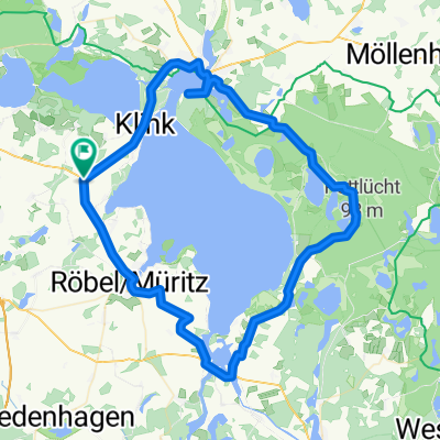
Overview
About this route
Due to the parking situation in Waren, it is advisable to start the route at another location. From Sembzin, the path initially leads towards Röbel via field and forest trails. In Zirzow, it is recommended to follow the bike path to the left. The path goes through meadows and after about 1 km joins the regular paved asphalt bike path. This way you avoid riding along the main road and enjoy a wonderful view over the meadows. The route continues mostly on well-developed bike paths towards Röbel, although these can be very crowded around Röbel. From the port of Röbel, the bike path signage is somewhat of a disaster! Through the town, you cycle on the road, and with some luck, you find the entrance to the Müritz Cycle Path again. A small sign indicates an entrance to a garden area that looks more like a farm driveway. Through the garden area, a well-developed path leads around the Great Wünnow and merges into a forest path. This path leads through forest and meadows along the lake before turning towards Ludorf. In Ludorf, keep to the left, then ride between the beautiful church and the restored manor house back towards the lake. Towards Zielow, the route goes through horse paddocks on paved paths with many sharp curves (caution!). From Vipperow, follow the B 198 on a bike path to Rechlin. At the pedestrian traffic light, the signage is a bit confusing. It is best to follow the road through Rechlin, as the bike path is hidden and quite winding anyway and rejoins this road. At the end of Rechlin, there is a cycling rest stop with really good soft ice cream and, if needed, hearty food at very moderate prices. The ride continues through Rechlin North (industrial area) and then on a well-developed bike path along the road through the forest to Boeck. At the National Park Center (a good place to rest), keep left. The very well developed gravel path leads through the national park. The route is very well signposted. There are several viewpoints on the tour that are definitely worth climbing. In Schwarzenhof is the national park information center, which is worth a visit. Towards Waren, the route goes on well-paved (bicycle) roads, from Federow through the forest. Be sure to stop at Lake Feisneck. There is a jetty offering a wonderful view of the lake. However, it is quite hidden, so you have to be careful not to miss it. From there, an asphalt bike path leads to Waren. At the harbor, it's time for a break. The Italian restaurant there is a MUST! Refreshed and with new energy, head towards the destination via Kamerun and Klink right along the lake, where the bike path is very busy. Behind Klink it gets quieter. Here awaits the last short climb and then the well-deserved descent to Sembzin.
- -:--
- Duration
- 83.9 km
- Distance
- 121 m
- Ascent
- 124 m
- Descent
- ---
- Avg. speed
- ---
- Max. altitude
Route quality
Waytypes & surfaces along the route
Waytypes
Path
36.1 km
(43 %)
Track
18.5 km
(22 %)
Surfaces
Paved
44.5 km
(53 %)
Unpaved
21.8 km
(26 %)
Asphalt
41.1 km
(49 %)
Loose gravel
6.7 km
(8 %)
Continue with Bikemap
Use, edit, or download this cycling route
You would like to ride Müritzrundt or customize it for your own trip? Here is what you can do with this Bikemap route:
Free features
- Save this route as favorite or in collections
- Copy & plan your own version of this route
- Split it into stages to create a multi-day tour
- Sync your route with Garmin or Wahoo
Premium features
Free trial for 3 days, or one-time payment. More about Bikemap Premium.
- Navigate this route on iOS & Android
- Export a GPX / KML file of this route
- Create your custom printout (try it for free)
- Download this route for offline navigation
Discover more Premium features.
Get Bikemap PremiumFrom our community
Other popular routes starting in Klink
 Müritz-Runde Klink
- Distance
- 86.1 km
- Ascent
- 153 m
- Descent
- 160 m
- Location
- Klink, Mecklenburg-Vorpommern, Germany
 Klink-Müritz-Klink
- Distance
- 8.8 km
- Ascent
- 36 m
- Descent
- 38 m
- Location
- Klink, Mecklenburg-Vorpommern, Germany
 Ausflug zum Fleesensee (Tag 3)
- Distance
- 47.2 km
- Ascent
- 184 m
- Descent
- 181 m
- Location
- Klink, Mecklenburg-Vorpommern, Germany
 klink-unterföhren
- Distance
- 11.8 km
- Ascent
- 53 m
- Descent
- 45 m
- Location
- Klink, Mecklenburg-Vorpommern, Germany
 Müritzrundtour
- Distance
- 73.8 km
- Ascent
- 346 m
- Descent
- 343 m
- Location
- Klink, Mecklenburg-Vorpommern, Germany
 Klink-Minzow-Sietow
- Distance
- 54.2 km
- Ascent
- 104 m
- Descent
- 113 m
- Location
- Klink, Mecklenburg-Vorpommern, Germany
 Rund um die Müritz (Test)
- Distance
- 107.9 km
- Ascent
- 159 m
- Descent
- 161 m
- Location
- Klink, Mecklenburg-Vorpommern, Germany
 Rund um Kölpin- und Fleesensee
- Distance
- 46.3 km
- Ascent
- 280 m
- Descent
- 289 m
- Location
- Klink, Mecklenburg-Vorpommern, Germany
Open it in the app