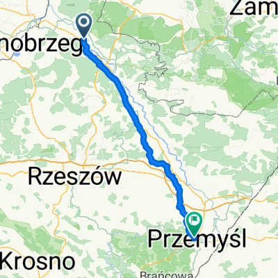
Rowerowa trasa do PxM 2011/2012
A cycling route starting in Stalowa Wola, Subcarpathian Voivodeship, Poland.
Overview
About this route
Trasa do PxM, z punktu:
- A (Al. Jana Paw艂a II, Stalowa Wola)
do punktu:
- B (Ul. Stalowa 5, Rudnik N/Sanem)
i z powrotem do punktu A.
- -:--
- Duration
- 44.8 km
- Distance
- 57 m
- Ascent
- 57 m
- Descent
- ---
- Avg. speed
- ---
- Avg. speed
Route quality
Waytypes & surfaces along the route
Waytypes
Quiet road
15.5 km
(35 %)
Cycleway
13.7 km
(31 %)
Surfaces
Paved
24.8 km
(55 %)
Unpaved
1.6 km
(4 %)
Asphalt
19.2 km
(43 %)
Paved (undefined)
5.6 km
(13 %)
Route highlights
Points of interest along the route
Point of interest after 22.3 km
Ul. Stalowa 5 oddzia艂 Polimex-Mostostal ZWS Rudnik
Continue with Bikemap
Use, edit, or download this cycling route
You would like to ride Rowerowa trasa do PxM 2011/2012 or customize it for your own trip? Here is what you can do with this Bikemap route:
Free features
- Save this route as favorite or in collections
- Copy & plan your own version of this route
- Sync your route with Garmin or Wahoo
Premium features
Free trial for 3 days, or one-time payment. More about Bikemap Premium.
- Navigate this route on iOS & Android
- Export a GPX / KML file of this route
- Create your custom printout (try it for free)
- Download this route for offline navigation
Discover more Premium features.
Get Bikemap PremiumFrom our community
Other popular routes starting in Stalowa Wola
- Rowerowa trasa do PxM 2011/2012
- Distance
- 44.8 km
- Ascent
- 57 m
- Descent
- 57 m
- Location
- Stalowa Wola, Subcarpathian Voivodeship, Poland
- Chwilowo nie pada wi臋c jad臋 na grzyby
- Distance
- 19.9 km
- Ascent
- 67 m
- Descent
- 67 m
- Location
- Stalowa Wola, Subcarpathian Voivodeship, Poland
- Lekki powiem wiosny
- Distance
- 36.2 km
- Ascent
- 35 m
- Descent
- 32 m
- Location
- Stalowa Wola, Subcarpathian Voivodeship, Poland
- 艁膮cznik Greenvelo przez Lasy Pa艅stwowe
- Distance
- 12.7 km
- Ascent
- 33 m
- Descent
- 30 m
- Location
- Stalowa Wola, Subcarpathian Voivodeship, Poland
- Lengthy bike tour from 15 sierpnia, 10:03
- Distance
- 49.3 km
- Ascent
- 94 m
- Descent
- 96 m
- Location
- Stalowa Wola, Subcarpathian Voivodeship, Poland
- Stalowa Wola Rozwad贸w - Huta Szklana
- Distance
- 123.9 km
- Ascent
- 810 m
- Descent
- 537 m
- Location
- Stalowa Wola, Subcarpathian Voivodeship, Poland
- BIKE.TOUR.2014 ROZTOCZE
- Distance
- 236.3 km
- Ascent
- 329 m
- Descent
- 323 m
- Location
- Stalowa Wola, Subcarpathian Voivodeship, Poland
- Wy艣mienita i wszechstronna trasa na wierczorne: bieganie/jazd臋 na rolkach/jazd臋 na rowerze.
- Distance
- 6.4 km
- Ascent
- 24 m
- Descent
- 26 m
- Location
- Stalowa Wola, Subcarpathian Voivodeship, Poland
Open it in the app