MTB Untersteinach zur Gänskopfhütte
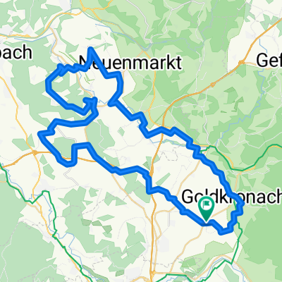
A cycling route starting in Reuth, Bavaria, Germany.
Overview
About this route
MTB tour starting from Untersteinach --> W-route to Kattersreuth --> Hammerschmiede --> Isakaberg --> Muckenreuth --> Gänskopf hut and back. The path is mostly in the forest or on gravel. About 1200 m of elevation gain are covered and there is also a small wrong turn on the route. Anyway, have fun REPEATING IT:
- -:--
- Duration
- 33.5 km
- Distance
- 1,067 m
- Ascent
- 1,065 m
- Descent
- ---
- Avg. speed
- ---
- Max. altitude
Continue with Bikemap
Use, edit, or download this cycling route
You would like to ride MTB Untersteinach zur Gänskopfhütte or customize it for your own trip? Here is what you can do with this Bikemap route:
Free features
- Save this route as favorite or in collections
- Copy & plan your own version of this route
- Sync your route with Garmin or Wahoo
Premium features
Free trial for 3 days, or one-time payment. More about Bikemap Premium.
- Navigate this route on iOS & Android
- Export a GPX / KML file of this route
- Create your custom printout (try it for free)
- Download this route for offline navigation
Discover more Premium features.
Get Bikemap PremiumFrom our community
Other popular routes starting in Reuth
- Bildzeitungstour
- Distance
- 9.5 km
- Ascent
- 75 m
- Descent
- 110 m
- Location
- Reuth, Bavaria, Germany
- Dorfstraße 21, Goldkronach nach Hofäckerstraße 5, Hollfeld
- Distance
- 44.8 km
- Ascent
- 328 m
- Descent
- 399 m
- Location
- Reuth, Bavaria, Germany
- MTB Untersteinach zur Gänskopfhütte
- Distance
- 33.5 km
- Ascent
- 1,067 m
- Descent
- 1,065 m
- Location
- Reuth, Bavaria, Germany
- Recovered Route
- Distance
- 19.8 km
- Ascent
- 5 m
- Descent
- 9 m
- Location
- Reuth, Bavaria, Germany
- Deutschlandcross- Untersteinach-Selb
- Distance
- 84.1 km
- Ascent
- 1,266 m
- Descent
- 1,100 m
- Location
- Reuth, Bavaria, Germany
- Himmelsleiter
- Distance
- 16.4 km
- Ascent
- 542 m
- Descent
- 542 m
- Location
- Reuth, Bavaria, Germany
- SchöneAussichtTourRR
- Distance
- 61.7 km
- Ascent
- 820 m
- Descent
- 806 m
- Location
- Reuth, Bavaria, Germany
- Ä£“˜? nach Ä£“˜?
- Distance
- 13 km
- Ascent
- 160 m
- Descent
- 170 m
- Location
- Reuth, Bavaria, Germany
Open it in the app