

2012 French Tour -- Ride Day 58 -- 23 October 2012 -- Albi -- Circle
A cycling route starting in Albi, Occitanie, France.
Overview
About this route
To be added later...
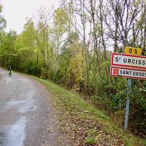
What a great ride through a variety of terrains. The D25, D27, D9, D73, D239 section had no traffic and plenty of steep uphills and downhills. Great countryside. D922 was a major road, but with little traffic and great riding. D30 was nice riding and D13 was a great low-traffic road for getting back into Albi. Note that there's no sign on D988 for D13. <div><br /></div>
- -:--
- Duration
- 100.3 km
- Distance
- 997 m
- Ascent
- 999 m
- Descent
- ---
- Avg. speed
- ---
- Max. altitude

Route quality
Waytypes & surfaces along the route
Waytypes
Road
59.2 km
(59 %)
Quiet road
7 km
(7 %)
Surfaces
Paved
9 km
(9 %)
Asphalt
9 km
(9 %)
Undefined
91.3 km
(91 %)
Continue with Bikemap
Use, edit, or download this cycling route
You would like to ride 2012 French Tour -- Ride Day 58 -- 23 October 2012 -- Albi -- Circle or customize it for your own trip? Here is what you can do with this Bikemap route:
Free features
- Save this route as favorite or in collections
- Copy & plan your own version of this route
- Split it into stages to create a multi-day tour
- Sync your route with Garmin or Wahoo
Premium features
Free trial for 3 days, or one-time payment. More about Bikemap Premium.
- Navigate this route on iOS & Android
- Export a GPX / KML file of this route
- Create your custom printout (try it for free)
- Download this route for offline navigation
Discover more Premium features.
Get Bikemap PremiumFrom our community
Other popular routes starting in Albi
 Albi to Montauban
- Distance
- 75.4 km
- Ascent
- 968 m
- Descent
- 1,022 m
- Location
- Albi, Occitanie, France
 2012 French Tour -- Ride Day 58 -- 23 October 2012 -- Albi -- Circle
- Distance
- 100.3 km
- Ascent
- 997 m
- Descent
- 999 m
- Location
- Albi, Occitanie, France
 2012 French Tour -- Ride Day 59 -- 25 October 2012 -- Albi -- Circle
- Distance
- 54.3 km
- Ascent
- 622 m
- Descent
- 622 m
- Location
- Albi, Occitanie, France
 Albi - Cordes (route de campagne)
- Distance
- 56.5 km
- Ascent
- 647 m
- Descent
- 635 m
- Location
- Albi, Occitanie, France
 2014 Ride Day 103 - Albi to Montauban
- Distance
- 74.1 km
- Ascent
- 387 m
- Descent
- 439 m
- Location
- Albi, Occitanie, France
 Open Tour. Etapa 1. Albi > Toulouse
- Distance
- 145.5 km
- Ascent
- 1,081 m
- Descent
- 1,109 m
- Location
- Albi, Occitanie, France
 Saint-Juéry - côte de Saint-Sernin
- Distance
- 98.6 km
- Ascent
- 3,184 m
- Descent
- 3,179 m
- Location
- Albi, Occitanie, France
 4. Albi - Brousse-le-Chateau
- Distance
- 70.3 km
- Ascent
- 904 m
- Descent
- 829 m
- Location
- Albi, Occitanie, France
Open it in the app