13 ZW3 Waldkirch-Kandel-Hexenloch
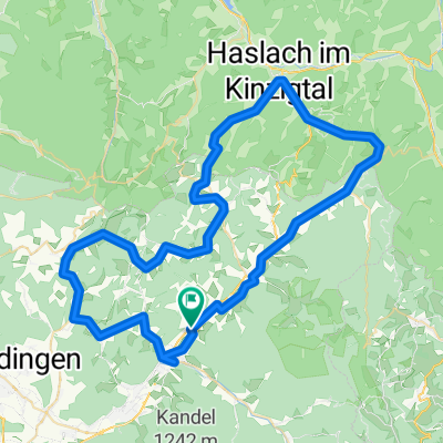
A cycling route starting in Gutach im Breisgau, Baden-Württemberg, Germany.
Overview
About this route
mooie klim naar de Kandel, glooiend via St-Peter en St-Märgen, afdaling via Hexenlochmühle
- -:--
- Duration
- 62.6 km
- Distance
- 1,234 m
- Ascent
- 1,233 m
- Descent
- ---
- Avg. speed
- ---
- Avg. speed
Route quality
Waytypes & surfaces along the route
Waytypes
Busy road
33.8 km
(54 %)
Road
18.8 km
(30 %)
Surfaces
Paved
57.7 km
(92 %)
Unpaved
0.7 km
(1 %)
Asphalt
57.7 km
(92 %)
Ground
0.5 km
(<1 %)
Continue with Bikemap
Use, edit, or download this cycling route
You would like to ride 13 ZW3 Waldkirch-Kandel-Hexenloch or customize it for your own trip? Here is what you can do with this Bikemap route:
Free features
- Save this route as favorite or in collections
- Copy & plan your own version of this route
- Sync your route with Garmin or Wahoo
Premium features
Free trial for 3 days, or one-time payment. More about Bikemap Premium.
- Navigate this route on iOS & Android
- Export a GPX / KML file of this route
- Create your custom printout (try it for free)
- Download this route for offline navigation
Discover more Premium features.
Get Bikemap PremiumFrom our community
Other popular routes starting in Gutach im Breisgau
- Simonswald-Kandel-Hinterzarten-Wildgutach
- Distance
- 85.8 km
- Ascent
- 1,696 m
- Descent
- 1,698 m
- Location
- Gutach im Breisgau, Baden-Württemberg, Germany
- Lange Radrunde durch Simonswald
- Distance
- 86.1 km
- Ascent
- 536 m
- Descent
- 536 m
- Location
- Gutach im Breisgau, Baden-Württemberg, Germany
- Kandelrundtour über Siensbacher Kandelstraße
- Distance
- 27.8 km
- Ascent
- 1,064 m
- Descent
- 1,064 m
- Location
- Gutach im Breisgau, Baden-Württemberg, Germany
- 13 ZW3 Waldkirch-Kandel-Hexenloch
- Distance
- 62.6 km
- Ascent
- 1,234 m
- Descent
- 1,233 m
- Location
- Gutach im Breisgau, Baden-Württemberg, Germany
- Feierabend Tour
- Distance
- 23.8 km
- Ascent
- 447 m
- Descent
- 445 m
- Location
- Gutach im Breisgau, Baden-Württemberg, Germany
- Aufnahme vom 05.06.2017, 22:16
- Distance
- 0 km
- Ascent
- 0 m
- Descent
- 0 m
- Location
- Gutach im Breisgau, Baden-Württemberg, Germany
- Zur Schutterquelle
- Distance
- 38.9 km
- Ascent
- 667 m
- Descent
- 557 m
- Location
- Gutach im Breisgau, Baden-Württemberg, Germany
- Lange Radrunde durch Simonswald
- Distance
- 85.9 km
- Ascent
- 512 m
- Descent
- 512 m
- Location
- Gutach im Breisgau, Baden-Württemberg, Germany
Open it in the app