

Freeride & Downhill
A cycling route starting in Tannenbergsthal, Saxony, Germany.
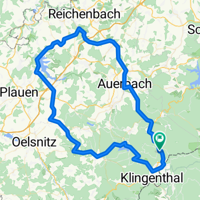
Overview
About this route
ACHTUNG: Nichts für Anfänger!
Diese beliebte Strecke beinhaltet Downhill, Freeride und Uphill. Kleine Nebentrails auch enthalten, auf denen man sein "Können" unter beweis stellen kann!
Los gehts in Klingenthal bei der Sommerrodelbahn & Endet auch dort!
Allen Teilnehmern wünsche ich viel Spaß!
- -:--
- Duration
- 31.9 km
- Distance
- 1,003 m
- Ascent
- 1,000 m
- Descent
- ---
- Avg. speed
- ---
- Max. altitude

Continue with Bikemap
Use, edit, or download this cycling route
You would like to ride Freeride & Downhill or customize it for your own trip? Here is what you can do with this Bikemap route:
Free features
- Save this route as favorite or in collections
- Copy & plan your own version of this route
- Sync your route with Garmin or Wahoo
Premium features
Free trial for 3 days, or one-time payment. More about Bikemap Premium.
- Navigate this route on iOS & Android
- Export a GPX / KML file of this route
- Create your custom printout (try it for free)
- Download this route for offline navigation
Discover more Premium features.
Get Bikemap PremiumFrom our community
Other popular routes starting in Tannenbergsthal
 Vogtland -2-
- Distance
- 93.5 km
- Ascent
- 1,141 m
- Descent
- 1,149 m
- Location
- Tannenbergsthal, Saxony, Germany
 Mühlleithen-Bublava-Brunndöbra-Mühlleithen
- Distance
- 17.8 km
- Ascent
- 427 m
- Descent
- 427 m
- Location
- Tannenbergsthal, Saxony, Germany
 Höhenmeter sammeln
- Distance
- 39.2 km
- Ascent
- 998 m
- Descent
- 963 m
- Location
- Tannenbergsthal, Saxony, Germany
 Mühlleithen-Zwenckau V3
- Distance
- 116 km
- Ascent
- 177 m
- Descent
- 905 m
- Location
- Tannenbergsthal, Saxony, Germany
 Kammtour Erzgebirge Auf dem höchsten Weg durch Sachsen und Böhmen - Kammtour Erzgebirge Auf dem höchsten Weg durch Sachsen und Böhmen
- Distance
- 233.8 km
- Ascent
- 2,873 m
- Descent
- 3,132 m
- Location
- Tannenbergsthal, Saxony, Germany
 Freeride & Downhill
- Distance
- 31.9 km
- Ascent
- 1,003 m
- Descent
- 1,000 m
- Location
- Tannenbergsthal, Saxony, Germany
 Gabriel-Baumann-Straße 8, Muldenhammer nach Klingenthaler Straße 3, Muldenhammer
- Distance
- 42.7 km
- Ascent
- 1,299 m
- Descent
- 1,282 m
- Location
- Tannenbergsthal, Saxony, Germany
 TBT - Klingenthal - TBT
- Distance
- 25.2 km
- Ascent
- 500 m
- Descent
- 500 m
- Location
- Tannenbergsthal, Saxony, Germany
Open it in the app