

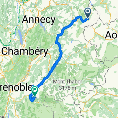
Le Bourg-d'Oisans - Chamonix-Mont-Blanc
A cycling route starting in Chamonix, Auvergne-Rhône-Alpes, France.
Overview
About this route
- -:--
- Duration
- 262 km
- Distance
- 5,001 m
- Ascent
- 5,334 m
- Descent
- ---
- Avg. speed
- ---
- Max. altitude

Route quality
Waytypes & surfaces along the route
Waytypes
Busy road
188.5 km
(72 %)
Road
31.1 km
(12 %)
Surfaces
Paved
175.3 km
(67 %)
Unpaved
1.7 km
(<1 %)
Asphalt
174.9 km
(67 %)
Gravel
0.9 km
(<1 %)
Route highlights
Points of interest along the route
Point of interest after 64.2 km
Col des Saisies
Point of interest after 104.3 km
Cormet de Roselend
Point of interest after 184.5 km
Col de la Madeleine
Point of interest after 225.6 km
Col du Glandon
Continue with Bikemap
Use, edit, or download this cycling route
You would like to ride Le Bourg-d'Oisans - Chamonix-Mont-Blanc or customize it for your own trip? Here is what you can do with this Bikemap route:
Free features
- Save this route as favorite or in collections
- Copy & plan your own version of this route
- Split it into stages to create a multi-day tour
- Sync your route with Garmin or Wahoo
Premium features
Free trial for 3 days, or one-time payment. More about Bikemap Premium.
- Navigate this route on iOS & Android
- Export a GPX / KML file of this route
- Create your custom printout (try it for free)
- Download this route for offline navigation
Discover more Premium features.
Get Bikemap PremiumFrom our community
Other popular routes starting in Chamonix
 Chamonix - Val d` Isère
- Distance
- 155.4 km
- Ascent
- 3,548 m
- Descent
- 2,748 m
- Location
- Chamonix, Auvergne-Rhône-Alpes, France
 Chamonix-Mont-Blanc to Lacd'Emosson
- Distance
- 32.4 km
- Ascent
- 1,622 m
- Descent
- 520 m
- Location
- Chamonix, Auvergne-Rhône-Alpes, France
 10km de Chamonix
- Distance
- 10 km
- Ascent
- 289 m
- Descent
- 289 m
- Location
- Chamonix, Auvergne-Rhône-Alpes, France
 Tour de Mont Blanc
- Distance
- 119.2 km
- Ascent
- 7,716 m
- Descent
- 7,175 m
- Location
- Chamonix, Auvergne-Rhône-Alpes, France
 Col de Balme, Col des Posettes Loop
- Distance
- 49.8 km
- Ascent
- 1,411 m
- Descent
- 1,413 m
- Location
- Chamonix, Auvergne-Rhône-Alpes, France
 MBC to Col des Montets
- Distance
- 11.3 km
- Ascent
- 456 m
- Descent
- 37 m
- Location
- Chamonix, Auvergne-Rhône-Alpes, France
 Chamonix - Finhaut Emosson
- Distance
- 32.2 km
- Ascent
- 1,309 m
- Descent
- 387 m
- Location
- Chamonix, Auvergne-Rhône-Alpes, France
 Ultimate Étapes, Stage 15: Cycling's Greatest Climb
- Distance
- 200.5 km
- Ascent
- 4,571 m
- Descent
- 3,759 m
- Location
- Chamonix, Auvergne-Rhône-Alpes, France
Open it in the app