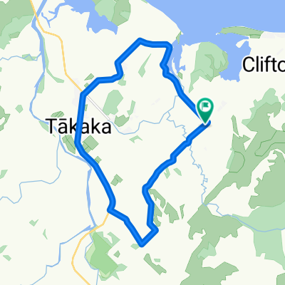
- 11.3 km
- 49 m
- 68 m
- Takaka, Tasman District, New Zealand
Lindsay's Bridge Circuit
A cycling route starting in Takaka, Tasman District, New Zealand.
Overview
About this route
This route covers the best of both worlds with gravel backroads with some grunty hills and stunning scenery; to a nice flat stretch along the main highway where you can really push yourself ..
Linday's Bridge (where Hwy & East Takaka Rd meet at southern end) aka Uruwhenua Reserve, is also a nice place to take a splash in the river, or make use of the shady picnic area & toilet facilities ..
- -:--
- Duration
- 29.5 km
- Distance
- 193 m
- Ascent
- 191 m
- Descent
- ---
- Avg. speed
- ---
- Max. altitude
created this 13 years ago
Route quality
Waytypes & surfaces along the route
Waytypes
Quiet road
14.4 km
(49 %)
Undefined
15 km
(51 %)
Surfaces
Paved
23.6 km
(80 %)
Unpaved
5.9 km
(20 %)
Paved (undefined)
23.6 km
(80 %)
Gravel
5.6 km
(19 %)
Unpaved (undefined)
0.3 km
(1 %)
Continue with Bikemap
Use, edit, or download this cycling route
You would like to ride Lindsay's Bridge Circuit or customize it for your own trip? Here is what you can do with this Bikemap route:
Free features
- Save this route as favorite or in collections
- Copy & plan your own version of this route
- Sync your route with Garmin or Wahoo
Premium features
Free trial for 3 days, or one-time payment. More about Bikemap Premium.
- Navigate this route on iOS & Android
- Export a GPX / KML file of this route
- Create your custom printout (try it for free)
- Download this route for offline navigation
Discover more Premium features.
Get Bikemap PremiumFrom our community
Other popular routes starting in Takaka
- 1239–1325 Takaka-Collingwood Highway, Onekaka to 3–23 Haven Road, Collingwood
- Takaka to Nelson
- 104.6 km
- 1,063 m
- 1,058 m
- Takaka, Tasman District, New Zealand
- Totaranui to Takaka
- 31.3 km
- 501 m
- 499 m
- Takaka, Tasman District, New Zealand
- -40.872° N 172.817° W to -40.872° N 172.817° W
- 15.3 km
- 668 m
- 669 m
- Takaka, Tasman District, New Zealand
- krasse tour
- 106.4 km
- 1,197 m
- 1,197 m
- Takaka, Tasman District, New Zealand
- takaka_Auckland
- 999.7 km
- 2,476 m
- 2,484 m
- Takaka, Tasman District, New Zealand
- Around the Block
- 15.2 km
- 106 m
- 105 m
- Takaka, Tasman District, New Zealand
- rameka
- 8.9 km
- 305 m
- 308 m
- Takaka, Tasman District, New Zealand
Open it in the app


