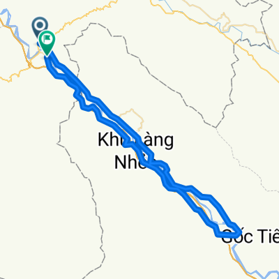
Test
A cycling route starting in Thị Trấn Phố Rà ng, Là o Cai Province, Vietnam.
Overview
About this route
- -:--
- Duration
- 76.4 km
- Distance
- 382 m
- Ascent
- 367 m
- Descent
- ---
- Avg. speed
- ---
- Max. altitude
Route quality
Waytypes & surfaces along the route
Waytypes
Road
4.6 km
(6 %)
Quiet road
4.6 km
(6 %)
Continue with Bikemap
Use, edit, or download this cycling route
You would like to ride Test or customize it for your own trip? Here is what you can do with this Bikemap route:
Free features
- Save this route as favorite or in collections
- Copy & plan your own version of this route
- Sync your route with Garmin or Wahoo
Premium features
Free trial for 3 days, or one-time payment. More about Bikemap Premium.
- Navigate this route on iOS & Android
- Export a GPX / KML file of this route
- Create your custom printout (try it for free)
- Download this route for offline navigation
Discover more Premium features.
Get Bikemap PremiumFrom our community
Other popular routes starting in Thị Trấn Phố Rà ng
14 Pho Rang - Yen Binh- Distance
- 88 km
- Ascent
- 589 m
- Descent
- 608 m
- Location
- Thị Trấn Phố Rà ng, Là o Cai Province, Vietnam
? Kiou Leou Ti - Bao Yen- Distance
- 123 km
- Ascent
- 2,044 m
- Descent
- 1,775 m
- Location
- Thị Trấn Phố Rà ng, Là o Cai Province, Vietnam
Pho Rang to Moa An- Distance
- 19.7 km
- Ascent
- 520 m
- Descent
- 522 m
- Location
- Thị Trấn Phố Rà ng, Là o Cai Province, Vietnam
J071 - Vendredi 20 mars 2015 - Lang Pho Rang - Yen Bai- Distance
- 91.4 km
- Ascent
- 416 m
- Descent
- 449 m
- Location
- Thị Trấn Phố Rà ng, Là o Cai Province, Vietnam
Day 13: Pho Rang - Viet Quang- Distance
- 66 km
- Ascent
- 506 m
- Descent
- 489 m
- Location
- Thị Trấn Phố Rà ng, Là o Cai Province, Vietnam
J067 - lundi 16 mars 2015 - Lang Khay - Lao Cai- Distance
- 93.8 km
- Ascent
- 718 m
- Descent
- 690 m
- Location
- Thị Trấn Phố Rà ng, Là o Cai Province, Vietnam
Test- Distance
- 76.4 km
- Ascent
- 382 m
- Descent
- 367 m
- Location
- Thị Trấn Phố Rà ng, Là o Cai Province, Vietnam
Bao Ha to Lai Chau(by Route 279)- Distance
- 147.7 km
- Ascent
- 2,742 m
- Descent
- 1,882 m
- Location
- Thị Trấn Phố Rà ng, Là o Cai Province, Vietnam
Open it in the app

