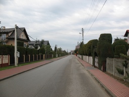
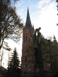
2012/17 Chorzelów - Gawłuszowice - Tuszów Narodowy
A cycling route starting in Mielec, Subcarpathian Voivodeship, Poland.
Overview
About this route
Route completed on November 3, 2012.
- -:--
- Duration
- 55.9 km
- Distance
- 27 m
- Ascent
- 27 m
- Descent
- ---
- Avg. speed
- ---
- Max. altitude
Route highlights
Points of interest along the route

Point of interest after 0.1 km
Chorzelów

Point of interest after 1.1 km
Chorzelów - Złotniki

Point of interest after 4.9 km
Chrząstów

Point of interest after 7.2 km
Brzyście, rzeka Wisłoka

Point of interest after 8.5 km
Brzyście

Point of interest after 8.6 km
Brzyście

Point of interest after 10 km
Borki Nizińskie

Point of interest after 10.7 km
Borki Nizińskie

Point of interest after 12.8 km
Borki Nizińskie - Kliszów

Point of interest after 14.4 km
Kliszów

Point of interest after 15.2 km
Gawłuszowice

Point of interest after 15.4 km
Gawłuszowice

Point of interest after 16 km
Gawłuszowice

Point of interest after 16.1 km
Gawłuszowice, kapliczka w miejscu dawnego kościoła zniszczonego przez Wisłokę

Point of interest after 16.6 km
Gawłuszowice, Wisłoka - widok w kierunku EEN

Point of interest after 16.8 km
Gawłuszowice, most na Wisłoce

Point of interest after 19.1 km
Sadkowa Góra (początek - Kąty), widok na S.

Point of interest after 19.5 km
Kąty - Ostrówek, rzeka Breń Stary - widok w kierunku S

Point of interest after 21.1 km
Wisła koło Połańca

Point of interest after 21.1 km
Ostrówek, Wisła, elektrownia Połaniec

Point of interest after 21.6 km
Ostrówek, dolina Wisły

Point of interest after 22 km
Ostrówek

Point of interest after 23.3 km
Zawierzbie, dolina Wisły przed wałem

Point of interest after 23.6 km
Zawierzbie, dolina Wisły, wał przeciwpowodziowy

Point of interest after 25.2 km
Zawierzbie, Wisła przy ujściu Wisłoki

Point of interest after 25.2 km
Zawierzbie, ujście Wisłoki do Wisły
Point of interest after 26.5 km

Point of interest after 27.1 km
Zawierzbie

Point of interest after 28.7 km
Gawłuszowice, rzeka Breń Stary - widok w kierunku NE.

Point of interest after 31.2 km
Gawłuszowice

Point of interest after 31.3 km
Gawłuszowice

Point of interest after 31.4 km
Wola Zdakowska

Point of interest after 33.7 km
Wola Zdakowska

Point of interest after 34.2 km
Wola Zdakowska - Rożniaty

Point of interest after 35.4 km
Krzemienica, Kanał Chorzelowsko - Dymitrowski

Point of interest after 35.4 km
Krzemienica

Point of interest after 37.7 km
Młodochów Mały

Point of interest after 38.7 km
Młodochów Mały - Jaślany

Point of interest after 40.9 km
Jaślany Bugaj

Point of interest after 42.8 km
Jaślany

Point of interest after 44 km
Jaślany - Pluty, Rów Potok, widok na N.

Point of interest after 46.3 km
Czajkowa, most na Babulówce
Point of interest after 46.3 km

Point of interest after 46.3 km
Czajkowa, rzeka Babulówka

Point of interest after 46.4 km
Czajkowa

Point of interest after 47.5 km
Czajkowa - Grochowe, Rów Potok - widok w kierunku Sarnowa.

Point of interest after 47.9 km
Grochowe (Dęby)

Point of interest after 50.7 km
Tuszów Narodowy

Point of interest after 51.6 km
Tuszów Narodowy, dom Gen. Wł. Sikorskiego

Point of interest after 52 km
Tuszów Narodowy

Point of interest after 52.7 km
Tuszów Mały

Point of interest after 53.8 km
Malinie

Point of interest after 54.4 km
Chorzelów (Smyków)

Point of interest after 54.7 km
Chorzelów - widok w kierunku N

Point of interest after 55.8 km
Chorzelów
Continue with Bikemap
Use, edit, or download this cycling route
You would like to ride 2012/17 Chorzelów - Gawłuszowice - Tuszów Narodowy or customize it for your own trip? Here is what you can do with this Bikemap route:
Free features
- Save this route as favorite or in collections
- Copy & plan your own version of this route
- Sync your route with Garmin or Wahoo
Premium features
Free trial for 3 days, or one-time payment. More about Bikemap Premium.
- Navigate this route on iOS & Android
- Export a GPX / KML file of this route
- Create your custom printout (try it for free)
- Download this route for offline navigation
Discover more Premium features.
Get Bikemap PremiumFrom our community
Other popular routes starting in Mielec
 Kolbuszowa - skansen
- Distance
- 64.1 km
- Ascent
- 154 m
- Descent
- 154 m
- Location
- Mielec, Subcarpathian Voivodeship, Poland
 2012/17 Chorzelów - Gawłuszowice - Tuszów Narodowy
- Distance
- 55.9 km
- Ascent
- 27 m
- Descent
- 27 m
- Location
- Mielec, Subcarpathian Voivodeship, Poland
 Czerwona trasa - Nadleśnictwo Mielec
- Distance
- 22.6 km
- Ascent
- 90 m
- Descent
- 86 m
- Location
- Mielec, Subcarpathian Voivodeship, Poland
 Ujście Wisłoki i dwór w Sadkowej Górze
- Distance
- 51.8 km
- Ascent
- 24 m
- Descent
- 22 m
- Location
- Mielec, Subcarpathian Voivodeship, Poland
 Zgórsko
- Distance
- 29.1 km
- Ascent
- 78 m
- Descent
- 80 m
- Location
- Mielec, Subcarpathian Voivodeship, Poland
 Dworki w Chorzelowie i Maliniu
- Distance
- 18.3 km
- Ascent
- 19 m
- Descent
- 19 m
- Location
- Mielec, Subcarpathian Voivodeship, Poland
 Wyścig o pietruszkę
- Distance
- 9 km
- Ascent
- 60 m
- Descent
- 62 m
- Location
- Mielec, Subcarpathian Voivodeship, Poland
 Tropicana 😎🌴
- Distance
- 17.7 km
- Ascent
- 419 m
- Descent
- 419 m
- Location
- Mielec, Subcarpathian Voivodeship, Poland
Open it in the app

