

Bangers on Bike Charity Ride 2010 : Day 1
A cycling route starting in Samut Sakhon, Samut Sakhon, Thailand.
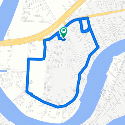
Overview
About this route
- -:--
- Duration
- 175.2 km
- Distance
- 54 m
- Ascent
- 48 m
- Descent
- ---
- Avg. speed
- ---
- Max. altitude
Continue with Bikemap
Use, edit, or download this cycling route
You would like to ride Bangers on Bike Charity Ride 2010 : Day 1 or customize it for your own trip? Here is what you can do with this Bikemap route:
Free features
- Save this route as favorite or in collections
- Copy & plan your own version of this route
- Split it into stages to create a multi-day tour
- Sync your route with Garmin or Wahoo
Premium features
Free trial for 3 days, or one-time payment. More about Bikemap Premium.
- Navigate this route on iOS & Android
- Export a GPX / KML file of this route
- Create your custom printout (try it for free)
- Download this route for offline navigation
Discover more Premium features.
Get Bikemap PremiumFrom our community
Other popular routes starting in Samut Sakhon
 Norarajuthit Soi 9 1604 to ถนน สายธนบุรี - ปากท่อ, Tambon Mae Klong
- Distance
- 44 km
- Ascent
- 29 m
- Descent
- 31 m
- Location
- Samut Sakhon, Samut Sakhon, Thailand
 Rama II Frontage Road, Tambon Tha Chin to Sukhumvit 20 Alley 84
- Distance
- 45.5 km
- Ascent
- 110 m
- Descent
- 108 m
- Location
- Samut Sakhon, Samut Sakhon, Thailand
 Bangkok to Hua Hin
- Distance
- 154.1 km
- Ascent
- 183 m
- Descent
- 178 m
- Location
- Samut Sakhon, Samut Sakhon, Thailand
 ซอย เอกชัย 4 90, ตำบล ท่าจีน to ซอย เอกชัย 4 90, ตำบล ท่าจีน2
- Distance
- 5.6 km
- Ascent
- 94 m
- Descent
- 103 m
- Location
- Samut Sakhon, Samut Sakhon, Thailand
 Samut Sakhon to Samut Songkhram
- Distance
- 43.1 km
- Ascent
- 22 m
- Descent
- 19 m
- Location
- Samut Sakhon, Samut Sakhon, Thailand
 01#01.001.0-SamutSakhon_SamutSongkhram48km
- Distance
- 48.2 km
- Ascent
- 67 m
- Descent
- 68 m
- Location
- Samut Sakhon, Samut Sakhon, Thailand
 Rondje Zuid Thailand
- Distance
- 1,826.4 km
- Ascent
- 6,767 m
- Descent
- 6,764 m
- Location
- Samut Sakhon, Samut Sakhon, Thailand
 15 พ.ย. 2557 07:33
- Distance
- 26.6 km
- Ascent
- 15 m
- Descent
- 18 m
- Location
- Samut Sakhon, Samut Sakhon, Thailand
Open it in the app