- 47.7 km
- 439 m
- 439 m
- Czarny Bór, Lower Silesian Voivodeship, Poland
Jabłów-Przełęcz Kowarska-Wieściszowice-Witków-Jabłów
A cycling route starting in Czarny Bór, Lower Silesian Voivodeship, Poland.
Overview
About this route
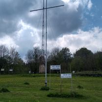
A very picturesque route through the Karkonosze and Rudawy Janowickie Mountains, but also very demanding. The route passes near the Colorful Lakes and the Bukówka Reservoir.
- -:--
- Duration
- 77.6 km
- Distance
- 815 m
- Ascent
- 815 m
- Descent
- ---
- Avg. speed
- ---
- Max. altitude
Dominik Bukowski
created this 13 years ago
Route quality
Waytypes & surfaces along the route
Waytypes
Road
31 km
(40 %)
Quiet road
7.8 km
(10 %)
Surfaces
Paved
57.4 km
(74 %)
Unpaved
1.6 km
(2 %)
Asphalt
56.6 km
(73 %)
Paved (undefined)
0.8 km
(1 %)
Continue with Bikemap
Use, edit, or download this cycling route
You would like to ride Jabłów-Przełęcz Kowarska-Wieściszowice-Witków-Jabłów or customize it for your own trip? Here is what you can do with this Bikemap route:
Free features
- Save this route as favorite or in collections
- Copy & plan your own version of this route
- Sync your route with Garmin or Wahoo
Premium features
Free trial for 3 days, or one-time payment. More about Bikemap Premium.
- Navigate this route on iOS & Android
- Export a GPX / KML file of this route
- Create your custom printout (try it for free)
- Download this route for offline navigation
Discover more Premium features.
Get Bikemap PremiumFrom our community
Other popular routes starting in Czarny Bór
- Jabłów-Wałbrzych-Kuźnice-Witków-Jabłów
- Jabłów-Przełęcz Kowarska-Wieściszowice-Witków-Jabłów
- 77.6 km
- 815 m
- 815 m
- Czarny Bór, Lower Silesian Voivodeship, Poland
- Jabłów-Kowarska-Redzinska-Jabłów
- 84.7 km
- 847 m
- 845 m
- Czarny Bór, Lower Silesian Voivodeship, Poland
- Romualda Traugutta 14, Boguszów-Gorce do Romualda Traugutta 14, Boguszów-Gorce
- 27.2 km
- 641 m
- 634 m
- Czarny Bór, Lower Silesian Voivodeship, Poland
- Boguszów-Gorce, przełęcz Rędzińska, Krzeszów, B.Gorce
- 63.2 km
- 505 m
- 500 m
- Czarny Bór, Lower Silesian Voivodeship, Poland
- Goguszów Gorce i Rudawski Park Krajobrazowy
- 62.2 km
- 645 m
- 616 m
- Czarny Bór, Lower Silesian Voivodeship, Poland
- Trójgarb- Chełmiec- Mniszek
- 35.7 km
- 1,092 m
- 1,095 m
- Czarny Bór, Lower Silesian Voivodeship, Poland
- Jabłów Rędzińska Kowarska Kamienna Jabłów
- 81.9 km
- 886 m
- 887 m
- Czarny Bór, Lower Silesian Voivodeship, Poland
Open it in the app


