

Sulle Piste di enduro
A cycling route starting in Grottazzolina, The Marches, Italy.
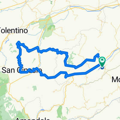
Overview
About this route
Introduction
The track, taken from MTB-Forum, is generally traversed by enduro riders. Everyone may take inspiration at their leisure...
<span style='font-family: arial, helvetica, clean, sans-serif; font-size: 13px; line-height: 16px; color: #000000;'>On the enduro tracks of Salino, Tennacola and Tenna.<br />The route is part of the motorbike tour 'motosmatata' for enduro bikes and quads.<br />The off-road sections include everything: gravel roads, dirt tracks, sand, cobblestones, many fords, steep climbs, short difficult descents and long uphill stretches. In some cases, you need to push for short stretches, both due to the slope and because of the cultivation state of two adjacent agricultural lands.<br />The surface is shaped by the passage of enduro bikes and quads. Impassable during and after rains, as well as from November to March/April (depending on rainfall). The paved connecting stretches are 6, some newly paved, others in very poor maintenance condition.<br />It is recommended to bring everything needed for repairs, including chain lubricant.</span>
<span style='font-family: arial, helvetica, clean, sans-serif; font-size: 13px; line-height: 16px; color: #000000;'>How to reach the starting point.</span>
<span style='font-family: arial, helvetica, clean, sans-serif; font-size: 13px; line-height: 16px; color: #000000;'>Grottazzolina (FM), at the intersection of Via Cristoforo Colombo and Strada Fermana near the statue of Pope John XXIII (location known by this name).</span><span style='font-family: arial, helvetica, clean, sans-serif; font-size: 13px; line-height: 16px; color: #000000;'>There is a large area to park.</span>
- -:--
- Duration
- 64.1 km
- Distance
- 940 m
- Ascent
- 936 m
- Descent
- ---
- Avg. speed
- ---
- Max. altitude

Continue with Bikemap
Use, edit, or download this cycling route
You would like to ride Sulle Piste di enduro or customize it for your own trip? Here is what you can do with this Bikemap route:
Free features
- Save this route as favorite or in collections
- Copy & plan your own version of this route
- Sync your route with Garmin or Wahoo
Premium features
Free trial for 3 days, or one-time payment. More about Bikemap Premium.
- Navigate this route on iOS & Android
- Export a GPX / KML file of this route
- Create your custom printout (try it for free)
- Download this route for offline navigation
Discover more Premium features.
Get Bikemap PremiumFrom our community
Other popular routes starting in Grottazzolina
 28/09/2020
- Distance
- 23.9 km
- Ascent
- 279 m
- Descent
- 287 m
- Location
- Grottazzolina, The Marches, Italy
 macina-abb.fiastra-sanginesio-falerone
- Distance
- 95.3 km
- Ascent
- 1,125 m
- Descent
- 1,125 m
- Location
- Grottazzolina, The Marches, Italy
 Domenica 17/10/2020
- Distance
- 22.6 km
- Ascent
- 129 m
- Descent
- 137 m
- Location
- Grottazzolina, The Marches, Italy
 san ginesio colmurano
- Distance
- 88.2 km
- Ascent
- 1,338 m
- Descent
- 1,338 m
- Location
- Grottazzolina, The Marches, Italy
 Sulle Piste di enduro
- Distance
- 64.1 km
- Ascent
- 940 m
- Descent
- 936 m
- Location
- Grottazzolina, The Marches, Italy
 grottazzolina-belmonte piceno
- Distance
- 44 km
- Ascent
- 825 m
- Descent
- 828 m
- Location
- Grottazzolina, The Marches, Italy
 Giro delle ciliegie
- Distance
- 78.5 km
- Ascent
- 1,291 m
- Descent
- 1,291 m
- Location
- Grottazzolina, The Marches, Italy
 20-05-17
- Distance
- 79.4 km
- Ascent
- 665 m
- Descent
- 664 m
- Location
- Grottazzolina, The Marches, Italy
Open it in the app