

Mittellange Route
A cycling route starting in Selmsdorf, Mecklenburg-Vorpommern, Germany.
Overview
About this route
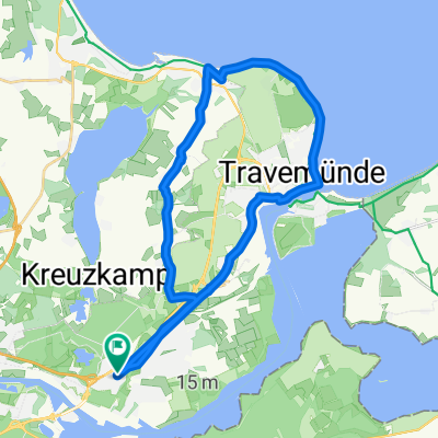
Mittellange Route Um Hemmelsdorfer See und Ostholstein (inkl. Pariner Berg)
- -:--
- Duration
- 64.6 km
- Distance
- 167 m
- Ascent
- 167 m
- Descent
- ---
- Avg. speed
- ---
- Max. altitude

Continue with Bikemap
Use, edit, or download this cycling route
You would like to ride Mittellange Route or customize it for your own trip? Here is what you can do with this Bikemap route:
Free features
- Save this route as favorite or in collections
- Copy & plan your own version of this route
- Sync your route with Garmin or Wahoo
Premium features
Free trial for 3 days, or one-time payment. More about Bikemap Premium.
- Navigate this route on iOS & Android
- Export a GPX / KML file of this route
- Create your custom printout (try it for free)
- Download this route for offline navigation
Discover more Premium features.
Get Bikemap PremiumFrom our community
Other popular routes starting in Selmsdorf
 Mittellange Route
- Distance
- 64.6 km
- Ascent
- 167 m
- Descent
- 167 m
- Location
- Selmsdorf, Mecklenburg-Vorpommern, Germany
 Lübeck - Stralsund Sommer 2021
- Distance
- 291.2 km
- Ascent
- 919 m
- Descent
- 926 m
- Location
- Selmsdorf, Mecklenburg-Vorpommern, Germany
 Gemütliche Fahrt
- Distance
- 10.2 km
- Ascent
- 57 m
- Descent
- 43 m
- Location
- Selmsdorf, Mecklenburg-Vorpommern, Germany
 Rundfahrt Küchnitz- Bad Schwartau
- Distance
- 22.4 km
- Ascent
- 95 m
- Descent
- 95 m
- Location
- Selmsdorf, Mecklenburg-Vorpommern, Germany
 Kücknitz-Pariner Berg-Gleschendorf-Kücknitz
- Distance
- 53.3 km
- Ascent
- 256 m
- Descent
- 255 m
- Location
- Selmsdorf, Mecklenburg-Vorpommern, Germany
 Brodtener Ufer
- Distance
- 23.1 km
- Ascent
- 64 m
- Descent
- 70 m
- Location
- Selmsdorf, Mecklenburg-Vorpommern, Germany
 lübeck bis gächlingen
- Distance
- 975.5 km
- Ascent
- 1,435 m
- Descent
- 1,015 m
- Location
- Selmsdorf, Mecklenburg-Vorpommern, Germany
 von Lübeck-Kücknitz über Brodtener Steilufer
- Distance
- 27 km
- Ascent
- 80 m
- Descent
- 80 m
- Location
- Selmsdorf, Mecklenburg-Vorpommern, Germany
Open it in the app