

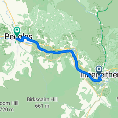
St Wilfrid's Way-Innerleithen via Cardrona to Peebles
A cycling route starting in Innerleithen, Scotland, United Kingdom.
Overview
About this route
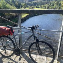
Scenic road through hills along Tweed
http://www.thewayofstandrews.com- -:--
- Duration
- 12 km
- Distance
- 141 m
- Ascent
- 139 m
- Descent
- ---
- Avg. speed
- ---
- Max. altitude

Route quality
Waytypes & surfaces along the route
Surfaces
Paved
11.6 km
(97 %)
Asphalt
11.6 km
(97 %)
Undefined
0.4 km
(3 %)
Continue with Bikemap
Use, edit, or download this cycling route
You would like to ride St Wilfrid's Way-Innerleithen via Cardrona to Peebles or customize it for your own trip? Here is what you can do with this Bikemap route:
Free features
- Save this route as favorite or in collections
- Copy & plan your own version of this route
- Sync your route with Garmin or Wahoo
Premium features
Free trial for 3 days, or one-time payment. More about Bikemap Premium.
- Navigate this route on iOS & Android
- Export a GPX / KML file of this route
- Create your custom printout (try it for free)
- Download this route for offline navigation
Discover more Premium features.
Get Bikemap PremiumFrom our community
Other popular routes starting in Innerleithen
 borders loop
- Distance
- 84.6 km
- Ascent
- 675 m
- Descent
- 676 m
- Location
- Innerleithen, Scotland, United Kingdom
 Day 2 - Innerleithen to Berwick on Tweed #PelotonToWimbledon
- Distance
- 101.1 km
- Ascent
- 339 m
- Descent
- 459 m
- Location
- Innerleithen, Scotland, United Kingdom
 St Andrews Pilgrimage, from southern upland way to edinburgh
- Distance
- 65.3 km
- Ascent
- 677 m
- Descent
- 765 m
- Location
- Innerleithen, Scotland, United Kingdom
 Innerleithan
- Distance
- 59.9 km
- Ascent
- 1,421 m
- Descent
- 1,423 m
- Location
- Innerleithen, Scotland, United Kingdom
 Route England/Scotland day 16
- Distance
- 114.7 km
- Ascent
- 403 m
- Descent
- 540 m
- Location
- Innerleithen, Scotland, United Kingdom
 Marmion Cottage, Innerleithen to High Street, Peebles
- Distance
- 13.1 km
- Ascent
- 80 m
- Descent
- 68 m
- Location
- Innerleithen, Scotland, United Kingdom
 Peebles Road, Innerleithen to High Street, Peebles
- Distance
- 12.1 km
- Ascent
- 69 m
- Descent
- 50 m
- Location
- Innerleithen, Scotland, United Kingdom
 St Wilfrid's Way-Innerleithen via Cardrona to Peebles
- Distance
- 12 km
- Ascent
- 141 m
- Descent
- 139 m
- Location
- Innerleithen, Scotland, United Kingdom
Open it in the app