

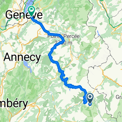
Briançon - Arc 2000
A cycling route starting in Séez, Auvergne-Rhône-Alpes, France.
Overview
About this route
- -:--
- Duration
- 203 km
- Distance
- 3,914 m
- Ascent
- 4,894 m
- Descent
- ---
- Avg. speed
- ---
- Max. altitude

Route highlights
Points of interest along the route
Point of interest after 71.6 km
Col de l'Iseran
Point of interest after 111 km
Col du Mont-Cenis
Point of interest after 186 km
Col de Montgenèvre
Continue with Bikemap
Use, edit, or download this cycling route
You would like to ride Briançon - Arc 2000 or customize it for your own trip? Here is what you can do with this Bikemap route:
Free features
- Save this route as favorite or in collections
- Copy & plan your own version of this route
- Split it into stages to create a multi-day tour
- Sync your route with Garmin or Wahoo
Premium features
Free trial for 3 days, or one-time payment. More about Bikemap Premium.
- Navigate this route on iOS & Android
- Export a GPX / KML file of this route
- Create your custom printout (try it for free)
- Download this route for offline navigation
Discover more Premium features.
Get Bikemap PremiumFrom our community
Other popular routes starting in Séez
 Grandes Alpes_Kudrna_Etapa3
- Distance
- 104.7 km
- Ascent
- 2,092 m
- Descent
- 1,817 m
- Location
- Séez, Auvergne-Rhône-Alpes, France
 Annemasse - Arc 2000
- Distance
- 179.2 km
- Ascent
- 3,155 m
- Descent
- 4,887 m
- Location
- Séez, Auvergne-Rhône-Alpes, France
 Briançon - Arc 2000
- Distance
- 203 km
- Ascent
- 3,914 m
- Descent
- 4,894 m
- Location
- Séez, Auvergne-Rhône-Alpes, France
 ALPOK EXPEDÍCIÓ (2015) 17. nap - Szerda
- Distance
- 193.2 km
- Ascent
- 831 m
- Descent
- 2,778 m
- Location
- Séez, Auvergne-Rhône-Alpes, France
 La Trank's
- Distance
- 4.2 km
- Ascent
- 28 m
- Descent
- 382 m
- Location
- Séez, Auvergne-Rhône-Alpes, France
 France Transalp Etappe3
- Distance
- 120.4 km
- Ascent
- 3,645 m
- Descent
- 3,080 m
- Location
- Séez, Auvergne-Rhône-Alpes, France
 Col de l'Iseran
- Distance
- 76.5 km
- Ascent
- 1,977 m
- Descent
- 1,473 m
- Location
- Séez, Auvergne-Rhône-Alpes, France
 45DN - Montgirod & back streets to La Monal bar
- Distance
- 51 km
- Ascent
- 833 m
- Descent
- 1,300 m
- Location
- Séez, Auvergne-Rhône-Alpes, France
Open it in the app