

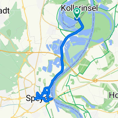
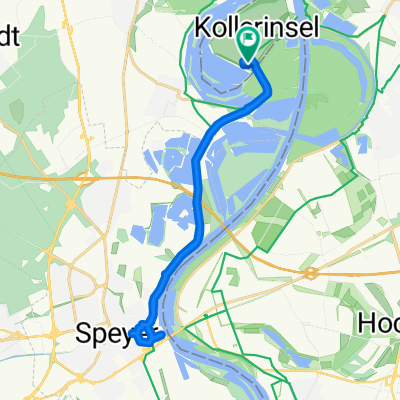
Stickelspitzer-Kraftwerks-Rundfahrt
A cycling route starting in Otterstadt, Rhineland-Palatinate, Germany.
Overview
About this route
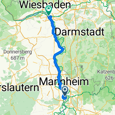
Tour from Otterstadt
-
about 45"
-
few roads. a lot of Rhine dike
-
beautiful landscape
- -:--
- Duration
- 20.5 km
- Distance
- 50 m
- Ascent
- 54 m
- Descent
- ---
- Avg. speed
- 105 m
- Max. altitude
Route quality
Waytypes & surfaces along the route
Waytypes
Track
17.6 km
(86 %)
Road
1 km
(5 %)
Surfaces
Paved
18.5 km
(90 %)
Unpaved
1.6 km
(8 %)
Asphalt
18.5 km
(90 %)
Unpaved (undefined)
1.4 km
(7 %)
Continue with Bikemap
Use, edit, or download this cycling route
You would like to ride Stickelspitzer-Kraftwerks-Rundfahrt or customize it for your own trip? Here is what you can do with this Bikemap route:
Free features
- Save this route as favorite or in collections
- Copy & plan your own version of this route
- Sync your route with Garmin or Wahoo
Premium features
Free trial for 3 days, or one-time payment. More about Bikemap Premium.
- Navigate this route on iOS & Android
- Export a GPX / KML file of this route
- Create your custom printout (try it for free)
- Download this route for offline navigation
Discover more Premium features.
Get Bikemap PremiumFrom our community
Other popular routes starting in Otterstadt
 Camping Kollersee nach Speyer zum Alten Hammer
- Distance
- 10.2 km
- Ascent
- 11 m
- Descent
- 59 m
- Location
- Otterstadt, Rhineland-Palatinate, Germany
 Camping Kollersee nach Camping Kollersee
- Distance
- 22.6 km
- Ascent
- 39 m
- Descent
- 91 m
- Location
- Otterstadt, Rhineland-Palatinate, Germany
 Camping Kollersee nach Schwetzingen Schlossgarten
- Distance
- 8.7 km
- Ascent
- 20 m
- Descent
- 67 m
- Location
- Otterstadt, Rhineland-Palatinate, Germany
 Camping Kollersee nach Camping Kollersee
- Distance
- 19.9 km
- Ascent
- 39 m
- Descent
- 83 m
- Location
- Otterstadt, Rhineland-Palatinate, Germany
 Nackenheim - Oberdiebach
- Distance
- 101.8 km
- Ascent
- 256 m
- Descent
- 266 m
- Location
- Otterstadt, Rhineland-Palatinate, Germany
 Camping Kollersee nach Camping Kollersee
- Distance
- 20.4 km
- Ascent
- 74 m
- Descent
- 123 m
- Location
- Otterstadt, Rhineland-Palatinate, Germany
 Stickelspitzer-Kraftwerks-Rundfahrt
- Distance
- 20.5 km
- Ascent
- 50 m
- Descent
- 54 m
- Location
- Otterstadt, Rhineland-Palatinate, Germany
 Umleitung_Otterstadt-Waldsee
- Distance
- 12.2 km
- Ascent
- 35 m
- Descent
- 32 m
- Location
- Otterstadt, Rhineland-Palatinate, Germany
Open it in the app