Trainingsrunde ´´2´´
A cycling route starting in Simmershofen, Bavaria, Germany.
Overview
About this route
Die erweiterte Trainingsrunde bis Steinbach .
- -:--
- Duration
- 41.6 km
- Distance
- 480 m
- Ascent
- 482 m
- Descent
- ---
- Avg. speed
- ---
- Avg. speed
Route quality
Waytypes & surfaces along the route
Waytypes
Track
24.1 km
(58 %)
Quiet road
10.6 km
(25 %)
Surfaces
Paved
11.3 km
(27 %)
Unpaved
18.2 km
(44 %)
Unpaved (undefined)
9.1 km
(22 %)
Asphalt
8.3 km
(20 %)
Continue with Bikemap
Use, edit, or download this cycling route
You would like to ride Trainingsrunde ´´2´´ or customize it for your own trip? Here is what you can do with this Bikemap route:
Free features
- Save this route as favorite or in collections
- Copy & plan your own version of this route
- Sync your route with Garmin or Wahoo
Premium features
Free trial for 3 days, or one-time payment. More about Bikemap Premium.
- Navigate this route on iOS & Android
- Export a GPX / KML file of this route
- Create your custom printout (try it for free)
- Download this route for offline navigation
Discover more Premium features.
Get Bikemap PremiumFrom our community
Other popular routes starting in Simmershofen
- Hohlach-Ochsenfurt und zurück
- Distance
- 39 km
- Ascent
- 315 m
- Descent
- 302 m
- Location
- Simmershofen, Bavaria, Germany
- Obstwanderweg Walkershofen (Camping-Paradies Franken)
- Distance
- 6.8 km
- Ascent
- 37 m
- Descent
- 37 m
- Location
- Simmershofen, Bavaria, Germany
- Easy ride in Simmershofen
- Distance
- 10 km
- Ascent
- 61 m
- Descent
- 64 m
- Location
- Simmershofen, Bavaria, Germany
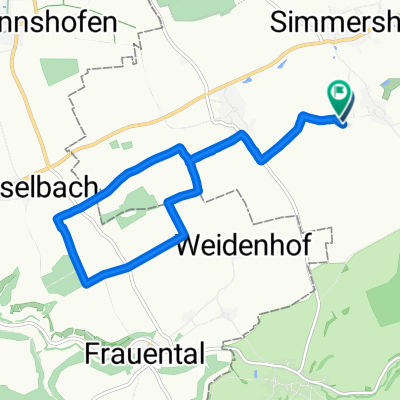
- Trainingsrunde durchs Taubertal
- Distance
- 29.4 km
- Ascent
- 426 m
- Descent
- 424 m
- Location
- Simmershofen, Bavaria, Germany
- 22. Sommer-Radeltour
- Distance
- 14.6 km
- Ascent
- 48 m
- Descent
- 103 m
- Location
- Simmershofen, Bavaria, Germany
- Über den Südrand des Steigerwaldes
- Distance
- 64 km
- Ascent
- 442 m
- Descent
- 442 m
- Location
- Simmershofen, Bavaria, Germany
- Trainingsrunde ´´2´´
- Distance
- 41.6 km
- Ascent
- 480 m
- Descent
- 482 m
- Location
- Simmershofen, Bavaria, Germany
- Eq-Gustenlohr-Ohrenbach-Eq
- Distance
- 30.5 km
- Ascent
- 222 m
- Descent
- 222 m
- Location
- Simmershofen, Bavaria, Germany
Open it in the app