

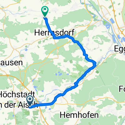
Höchstadt-Feuerstein-Kirchehrenbach-Baiersdorf-Höchstadt
A cycling route starting in Gremsdorf, Bavaria, Germany.
Overview
About this route
Nice route on small to medium roads. The first 25 km are very flat. Then there's a climb to the Feuerstein Castle. Up to Baiersdorf it will be a bit hilly, then at the end you can roll out easily.
- -:--
- Duration
- 80.5 km
- Distance
- 747 m
- Ascent
- 730 m
- Descent
- ---
- Avg. speed
- 516 m
- Max. altitude
Route quality
Waytypes & surfaces along the route
Waytypes
Road
33.8 km
(42 %)
Path
15.3 km
(19 %)
Surfaces
Paved
72.4 km
(90 %)
Unpaved
4.8 km
(6 %)
Asphalt
71.6 km
(89 %)
Gravel
2.4 km
(3 %)
Continue with Bikemap
Use, edit, or download this cycling route
You would like to ride Höchstadt-Feuerstein-Kirchehrenbach-Baiersdorf-Höchstadt or customize it for your own trip? Here is what you can do with this Bikemap route:
Free features
- Save this route as favorite or in collections
- Copy & plan your own version of this route
- Split it into stages to create a multi-day tour
- Sync your route with Garmin or Wahoo
Premium features
Free trial for 3 days, or one-time payment. More about Bikemap Premium.
- Navigate this route on iOS & Android
- Export a GPX / KML file of this route
- Create your custom printout (try it for free)
- Download this route for offline navigation
Discover more Premium features.
Get Bikemap PremiumFrom our community
Other popular routes starting in Gremsdorf
 2016 Bayern Tour,Aischtal Neustadt--Kanal Pfefferhütte
- Distance
- 98.1 km
- Ascent
- 396 m
- Descent
- 252 m
- Location
- Gremsdorf, Bavaria, Germany
 Aisch
Aisch- Distance
- 40.3 km
- Ascent
- 226 m
- Descent
- 226 m
- Location
- Gremsdorf, Bavaria, Germany
 2018 HBadK94 520
- Distance
- 93.9 km
- Ascent
- 504 m
- Descent
- 598 m
- Location
- Gremsdorf, Bavaria, Germany
 biengarten - biengarten!
- Distance
- 23.1 km
- Ascent
- 151 m
- Descent
- 150 m
- Location
- Gremsdorf, Bavaria, Germany
 Gremsdorf_Frensdorf
- Distance
- 26 km
- Ascent
- 229 m
- Descent
- 237 m
- Location
- Gremsdorf, Bavaria, Germany
 2019 HöS DON145
- Distance
- 144.7 km
- Ascent
- 581 m
- Descent
- 456 m
- Location
- Gremsdorf, Bavaria, Germany
 Höchstadt-Feuerstein-Kirchehrenbach-Baiersdorf-Höchstadt
- Distance
- 80.5 km
- Ascent
- 747 m
- Descent
- 730 m
- Location
- Gremsdorf, Bavaria, Germany
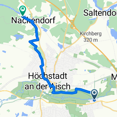 Nackendorf
- Distance
- 7.1 km
- Ascent
- 80 m
- Descent
- 34 m
- Location
- Gremsdorf, Bavaria, Germany
Open it in the app