

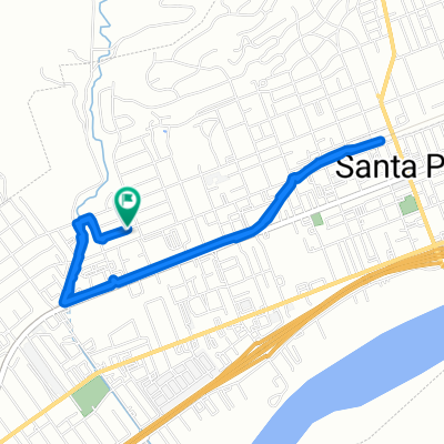
santa paula to ojai
A cycling route starting in Santa Paula, California, United States.
Overview
About this route
finish route on bike trail to ojai
- -:--
- Duration
- 32.1 km
- Distance
- 218 m
- Ascent
- 231 m
- Descent
- ---
- Avg. speed
- ---
- Max. altitude

Route quality
Waytypes & surfaces along the route
Waytypes
Road
18.6 km
(58 %)
Quiet road
4.2 km
(13 %)
Surfaces
Paved
3.9 km
(12 %)
Asphalt
2.2 km
(7 %)
Paved (undefined)
1 km
(3 %)
Continue with Bikemap
Use, edit, or download this cycling route
You would like to ride santa paula to ojai or customize it for your own trip? Here is what you can do with this Bikemap route:
Free features
- Save this route as favorite or in collections
- Copy & plan your own version of this route
- Sync your route with Garmin or Wahoo
Premium features
Free trial for 3 days, or one-time payment. More about Bikemap Premium.
- Navigate this route on iOS & Android
- Export a GPX / KML file of this route
- Create your custom printout (try it for free)
- Download this route for offline navigation
Discover more Premium features.
Get Bikemap PremiumFrom our community
Other popular routes starting in Santa Paula
 422 Dartmouth Rd, Santa Paula to 306 E Main St, Santa Paula
- Distance
- 2.5 km
- Ascent
- 10 m
- Descent
- 3 m
- Location
- Santa Paula, California, United States
 420 Dartmouth Rd, Santa Paula to 245 S Wells Rd, Ventura
- Distance
- 12.8 km
- Ascent
- 103 m
- Descent
- 108 m
- Location
- Santa Paula, California, United States
 Santa Paula to Camulos
- Distance
- 41 km
- Ascent
- 207 m
- Descent
- 70 m
- Location
- Santa Paula, California, United States
 West Telegraph Road 15887, Santa Paula to Acacia Road 450, Santa Paula
- Distance
- 10.8 km
- Ascent
- 25 m
- Descent
- 27 m
- Location
- Santa Paula, California, United States
 208 Eliot St, Santa Paula to 209 Eliot St, Santa Paula
- Distance
- 15.9 km
- Ascent
- 122 m
- Descent
- 123 m
- Location
- Santa Paula, California, United States
 208 Eliot St, Santa Paula to 209 Eliot St, Santa Paula
- Distance
- 5.8 km
- Ascent
- 16 m
- Descent
- 14 m
- Location
- Santa Paula, California, United States
 Community-Senior Center, Santa Paula to Acacia Road 450, Santa Paula
- Distance
- 5.5 km
- Ascent
- 4 m
- Descent
- 14 m
- Location
- Santa Paula, California, United States
 Route from 275 N Peck Rd, Santa Paula
- Distance
- 10.9 km
- Ascent
- 78 m
- Descent
- 69 m
- Location
- Santa Paula, California, United States
Open it in the app