

Garmisch-Hohenschwangau
A cycling route starting in Garmisch-Partenkirchen, Bavaria, Germany.
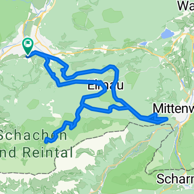
Overview
About this route
Radeln durch Europas größtem Moor:
Murnauer Moos
- -:--
- Duration
- 67.9 km
- Distance
- 488 m
- Ascent
- 391 m
- Descent
- ---
- Avg. speed
- ---
- Max. altitude

Route quality
Waytypes & surfaces along the route
Waytypes
Quiet road
30.5 km
(45 %)
Track
23.1 km
(34 %)
Surfaces
Paved
48.9 km
(72 %)
Unpaved
14.9 km
(22 %)
Asphalt
48.9 km
(72 %)
Gravel
8.1 km
(12 %)
Route highlights
Points of interest along the route

Point of interest after 2.2 km
Blick auf das Zugspitzmassif

Point of interest after 7.6 km
Klares Wasser bei der Schanze

Point of interest after 13.6 km
Blick auf die Alpen

Point of interest after 22.4 km
Murnauer Moos

Point of interest after 31.2 km
Bad Kohlgrub St. Martin

Point of interest after 38.6 km
Ammerland

Point of interest after 39.6 km
Halbammer

Point of interest after 59.7 km
Allgäuer Alpen mit Schloss Neuschwanstein

Point of interest after 64.4 km
Fussen
Continue with Bikemap
Use, edit, or download this cycling route
You would like to ride Garmisch-Hohenschwangau or customize it for your own trip? Here is what you can do with this Bikemap route:
Free features
- Save this route as favorite or in collections
- Copy & plan your own version of this route
- Sync your route with Garmin or Wahoo
Premium features
Free trial for 3 days, or one-time payment. More about Bikemap Premium.
- Navigate this route on iOS & Android
- Export a GPX / KML file of this route
- Create your custom printout (try it for free)
- Download this route for offline navigation
Discover more Premium features.
Get Bikemap PremiumFrom our community
Other popular routes starting in Garmisch-Partenkirchen
 Partenkirchen - Kreuzjoch - partnachklamm - Emau - Partenkirchen
- Distance
- 45.1 km
- Ascent
- 1,321 m
- Descent
- 1,321 m
- Location
- Garmisch-Partenkirchen, Bavaria, Germany
 Von Garmisch zum Schachen
- Distance
- 44.7 km
- Ascent
- 1,559 m
- Descent
- 1,556 m
- Location
- Garmisch-Partenkirchen, Bavaria, Germany
 Stepbergtrail - Garmisch
- Distance
- 26 km
- Ascent
- 1,183 m
- Descent
- 1,183 m
- Location
- Garmisch-Partenkirchen, Bavaria, Germany
 Garmisch Gardasee
- Distance
- 339.8 km
- Ascent
- 1,961 m
- Descent
- 2,586 m
- Location
- Garmisch-Partenkirchen, Bavaria, Germany
 Garmisch-Lautersee-Schachenhaus
- Distance
- 54.7 km
- Ascent
- 1,601 m
- Descent
- 1,598 m
- Location
- Garmisch-Partenkirchen, Bavaria, Germany
 Alpencross Einsteiger
- Distance
- 331.6 km
- Ascent
- 1,900 m
- Descent
- 2,522 m
- Location
- Garmisch-Partenkirchen, Bavaria, Germany
 Rundtour Wettersteingebirge
- Distance
- 157.6 km
- Ascent
- 3,314 m
- Descent
- 3,310 m
- Location
- Garmisch-Partenkirchen, Bavaria, Germany
 Garmisch-Ehrwald
- Distance
- 50.7 km
- Ascent
- 925 m
- Descent
- 926 m
- Location
- Garmisch-Partenkirchen, Bavaria, Germany
Open it in the app