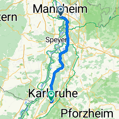
Mannheim-Brühl-Schwetzingen-Speyer-Hockenheim-Heidelberg-Seckenheim-Mannnheim (anspruchsvolle Tagestour)
A cycling route starting in Altrip, Rhineland-Palatinate, Germany.
Overview
About this route
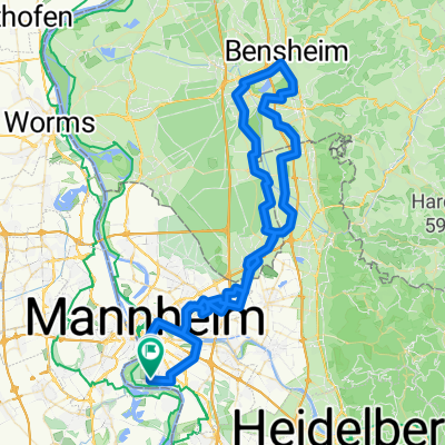
Die Strecke ist mit fast 80km Länge eine Tagestour für trainierte Radfahrer und ist zugleich in Teilen der bekannten ausgeschriebenen Kurzfalz-Route nachempfunden.
Angefangen in Mannheim geht es zunächst über Brühl nach Schwetzingen. In Schwetzingen empfiehlt es sich, den Schlossgarten zu besichtigen. Von Schwetzingen geht es anschließend über Ketsch zur Domstadt Speyer. Anschließend führt der Weg über Hockenheim zur weltbekannten Stadt Heidelberg mit den historischen Schlossruinen. Zum Abschluss des langen Tourtages geht es entlang dem Fluss Neckar über Seckenheim zurück nach Mannheim.
ACHTUNG: Es handelt sich hierbei um eine Freihand-Zeichnung der Strecke. An gewissen Punkten kann die Strecke von der Radweg-Führung leicht abweichen!
Viel Spaß beim Radeln.
- -:--
- Duration
- 78.8 km
- Distance
- 79 m
- Ascent
- 82 m
- Descent
- ---
- Avg. speed
- ---
- Avg. speed
Continue with Bikemap
Use, edit, or download this cycling route
You would like to ride Mannheim-Brühl-Schwetzingen-Speyer-Hockenheim-Heidelberg-Seckenheim-Mannnheim (anspruchsvolle Tagestour) or customize it for your own trip? Here is what you can do with this Bikemap route:
Free features
- Save this route as favorite or in collections
- Copy & plan your own version of this route
- Sync your route with Garmin or Wahoo
Premium features
Free trial for 3 days, or one-time payment. More about Bikemap Premium.
- Navigate this route on iOS & Android
- Export a GPX / KML file of this route
- Create your custom printout (try it for free)
- Download this route for offline navigation
Discover more Premium features.
Get Bikemap PremiumFrom our community
Other popular routes starting in Altrip
- Mannheim-Neckarau nach Mannheim-Fanklin und zurück
- Distance
- 29.4 km
- Ascent
- 174 m
- Descent
- 174 m
- Location
- Altrip, Rhineland-Palatinate, Germany
- Mannheim -Ketsch-Speyer-Altrip-Mannheim
- Distance
- 60.1 km
- Ascent
- 85 m
- Descent
- 83 m
- Location
- Altrip, Rhineland-Palatinate, Germany
- Königsstuhl - Wilhelmsfeld - Langenthal - Rothenberg - Rippenweier
- Distance
- 111.4 km
- Ascent
- 1,574 m
- Descent
- 1,576 m
- Location
- Altrip, Rhineland-Palatinate, Germany
- Neckarauer Straße 17, Mannheim nach Fischerstraße 48, Mannheim
- Distance
- 20.8 km
- Ascent
- 57 m
- Descent
- 57 m
- Location
- Altrip, Rhineland-Palatinate, Germany
- Apfelblütenweg
- Distance
- 46.2 km
- Ascent
- 315 m
- Descent
- 317 m
- Location
- Altrip, Rhineland-Palatinate, Germany
- Rheinau - Altrip - Brühl
- Distance
- 29.5 km
- Ascent
- 80 m
- Descent
- 80 m
- Location
- Altrip, Rhineland-Palatinate, Germany
- Weißer Stein - Langenthal - Rothenberg - Rippenweier
- Distance
- 97.3 km
- Ascent
- 1,755 m
- Descent
- 1,755 m
- Location
- Altrip, Rhineland-Palatinate, Germany
- Mannheim - Lampertheim
- Distance
- 41 km
- Ascent
- 37 m
- Descent
- 39 m
- Location
- Altrip, Rhineland-Palatinate, Germany
Open it in the app