

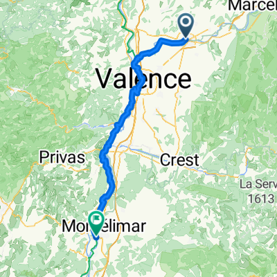
Romans s Isère > Die
A cycling route starting in Romans-sur-Isère, Auvergne-Rhône-Alpes, France.
Overview
About this route
Romans sur Isère
Pont-en-Royans
La chapelle-en-Vercors
Vassieux-en-Vercors
Col du Rousset
Die
- -:--
- Duration
- 86 km
- Distance
- 1,511 m
- Ascent
- 1,257 m
- Descent
- ---
- Avg. speed
- ---
- Max. altitude
Route quality
Waytypes & surfaces along the route
Waytypes
Quiet road
8.6 km
(10 %)
Road
2.6 km
(3 %)
Surfaces
Paved
57.6 km
(67 %)
Asphalt
56.8 km
(66 %)
Paved (undefined)
0.9 km
(1 %)
Undefined
28.4 km
(33 %)
Continue with Bikemap
Use, edit, or download this cycling route
You would like to ride Romans s Isère > Die or customize it for your own trip? Here is what you can do with this Bikemap route:
Free features
- Save this route as favorite or in collections
- Copy & plan your own version of this route
- Split it into stages to create a multi-day tour
- Sync your route with Garmin or Wahoo
Premium features
Free trial for 3 days, or one-time payment. More about Bikemap Premium.
- Navigate this route on iOS & Android
- Export a GPX / KML file of this route
- Create your custom printout (try it for free)
- Download this route for offline navigation
Discover more Premium features.
Get Bikemap PremiumFrom our community
Other popular routes starting in Romans-sur-Isère

EDGE 1030®
Romans-sur-Isère Cycling- Distance
- 5.8 km
- Ascent
- 116 m
- Descent
- 4 m
- Location
- Romans-sur-Isère, Auvergne-Rhône-Alpes, France
- aller palais facteur cheval
- Distance
- 30.8 km
- Ascent
- 627 m
- Descent
- 495 m
- Location
- Romans-sur-Isère, Auvergne-Rhône-Alpes, France
 From Bourg-de-Péage to Izeron
- Distance
- 38.8 km
- Ascent
- 356 m
- Descent
- 288 m
- Location
- Romans-sur-Isère, Auvergne-Rhône-Alpes, France
 Tour de France 2015 - Stage 16
- Distance
- 207.7 km
- Ascent
- 1,869 m
- Descent
- 1,283 m
- Location
- Romans-sur-Isère, Auvergne-Rhône-Alpes, France
 Romans-sur-Isère - Montélimar
- Distance
- 92 km
- Ascent
- 328 m
- Descent
- 402 m
- Location
- Romans-sur-Isère, Auvergne-Rhône-Alpes, France
 *11-X. Bourg-de-Péage - Mont Ventoux (162,5 Km)
- Distance
- 162.5 km
- Ascent
- 2,901 m
- Descent
- 1,158 m
- Location
- Romans-sur-Isère, Auvergne-Rhône-Alpes, France
 De 12bis Rue de la Gloriette, Romans-sur-Isère à 13 Rue de la Gloriette, Romans-sur-Isère
- Distance
- 11.2 km
- Ascent
- 9 m
- Descent
- 12 m
- Location
- Romans-sur-Isère, Auvergne-Rhône-Alpes, France
 Circuit Chatenay 98/1230
- Distance
- 98.2 km
- Ascent
- 1,077 m
- Descent
- 1,075 m
- Location
- Romans-sur-Isère, Auvergne-Rhône-Alpes, France
Open it in the app