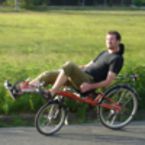
Beschauliche Tour von Siegelsdorf zur Cadolzburg
A cycling route starting in Veitsbronn, Bavaria, Germany.
Overview
About this route
This route runs along beautiful field and forest paths as well as little-trafficked secondary roads, making it suitable for hiking, enjoying nature, and for families (the child trailer should be suspended if necessary). However, there are no major potholes - just everything one understands by 'bike hiking trail'.
It starts at Siegel's train station. Aside from two inclines (right at the beginning and the castle hill in Cadolzburg), the route is actually rather flat and can be ridden without much effort. Since it runs a lot along field paths, one should choose a dry day.
Along the route there are always nice picnic spots. In Cadolzburg, the small castle beer garden or a street café invites you to stop. On the way back, the path makes a little loop over the village square of Veitsbronn, so that one can reward oneself after the completed tour with a delicious ice cream at 'Sergio'.
Have fun!
- -:--
- Duration
- 24.4 km
- Distance
- 204 m
- Ascent
- 197 m
- Descent
- ---
- Avg. speed
- 376 m
- Max. altitude
Route quality
Waytypes & surfaces along the route
Waytypes
Quiet road
9.5 km
(39 %)
Track
9.5 km
(39 %)
Surfaces
Paved
7.8 km
(32 %)
Unpaved
6.8 km
(28 %)
Asphalt
7.8 km
(32 %)
Gravel
4.9 km
(20 %)
Continue with Bikemap
Use, edit, or download this cycling route
You would like to ride Beschauliche Tour von Siegelsdorf zur Cadolzburg or customize it for your own trip? Here is what you can do with this Bikemap route:
Free features
- Save this route as favorite or in collections
- Copy & plan your own version of this route
- Sync your route with Garmin or Wahoo
Premium features
Free trial for 3 days, or one-time payment. More about Bikemap Premium.
- Navigate this route on iOS & Android
- Export a GPX / KML file of this route
- Create your custom printout (try it for free)
- Download this route for offline navigation
Discover more Premium features.
Get Bikemap PremiumFrom our community
Other popular routes starting in Veitsbronn
 Veitsbronn_42_km
- Distance
- 42.1 km
- Ascent
- 174 m
- Descent
- 175 m
- Location
- Veitsbronn, Bavaria, Germany
 Fahrt ins Blaue
- Distance
- 68.7 km
- Ascent
- 505 m
- Descent
- 472 m
- Location
- Veitsbronn, Bavaria, Germany
 Veitsbronn- Alte Hochstrasse - Laubendorf
- Distance
- 64.2 km
- Ascent
- 464 m
- Descent
- 463 m
- Location
- Veitsbronn, Bavaria, Germany
 Veitsbronn Cadolzburg Kirchfarrnbach
- Distance
- 50.9 km
- Ascent
- 439 m
- Descent
- 441 m
- Location
- Veitsbronn, Bavaria, Germany
 Veitsbronn - Oberreichenbach - Veitsbronn
- Distance
- 47.6 km
- Ascent
- 495 m
- Descent
- 498 m
- Location
- Veitsbronn, Bavaria, Germany
 MTB-Veitsbronn-Kanal-23km
- Distance
- 22.5 km
- Ascent
- 139 m
- Descent
- 139 m
- Location
- Veitsbronn, Bavaria, Germany
 Kleine Runde über Bräuersdorf
- Distance
- 23.3 km
- Ascent
- 170 m
- Descent
- 177 m
- Location
- Veitsbronn, Bavaria, Germany
 Große Mairunde
- Distance
- 110 km
- Ascent
- 870 m
- Descent
- 849 m
- Location
- Veitsbronn, Bavaria, Germany
Open it in the app


