ride retro 2012
- 31.5 km
- 201 m
- 221 m
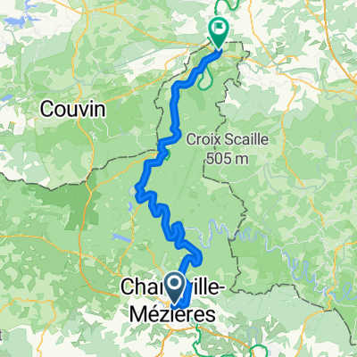
- Charleville-Mézières, Grand Est, France
A cycling route starting in Charleville-Mézières, Grand Est, France.
Overview
created this 13 years ago
Route quality
Road
42.2 km
(21 %)
Quiet road
42.2 km
(21 %)
Paved
74.4 km
(37 %)
Unpaved
2 km
(1 %)
Asphalt
74.4 km
(37 %)
Unpaved (undefined)
2 km
(1 %)
Undefined
124.7 km
(62 %)
Route highlights
Col de Sury 297 m
Côte des Mazures 391 m
Côte de la Neuville aux Haies 479 m
Côte Roc la Tour 400 m
Col du Liry 295 m
Col du Loup 383 m
Côte du Pré Pierret 419 m
Col de Cheveuges 282 m
Col de la Marfée 312 m
Montagne Saint Walfroy 350 m
Col de Lessy 306 m
Col de Sainte-Geneviève 348 m
Continue with Bikemap
You would like to ride Montmédy - Charleville-Mézières or customize it for your own trip? Here is what you can do with this Bikemap route:
Free trial for 3 days, or one-time payment. More about Bikemap Premium.
Discover more Premium features.
Get Bikemap PremiumFrom our community
Open it in the app