

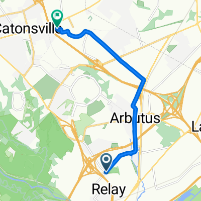
UMBC-Patapsco-Ellicott City-Oella- Catonsville
A cycling route starting in Arbutus, Maryland, United States.
Overview
About this route
In and out of Patapsco Valley a few times.
for some hill workouts.
2 Climbs and a few miles saved by staying
in Patapsco State Park and following river to Elllicott City/Oella.
- -:--
- Duration
- 37.5 km
- Distance
- 524 m
- Ascent
- 492 m
- Descent
- ---
- Avg. speed
- 161 m
- Max. altitude
Route quality
Waytypes & surfaces along the route
Waytypes
Road
20.9 km
(56 %)
Busy road
8 km
(21 %)
Surfaces
Paved
10 km
(27 %)
Asphalt
9.8 km
(26 %)
Concrete
0.2 km
(<1 %)
Undefined
27.5 km
(73 %)
Route highlights
Points of interest along the route
Point of interest after 1.7 km
Left at Selford/Sulphur Spring Rds
Point of interest after 6.7 km
Option-In Patapsco St Park, stay on north/east side of river, on path through park to end. Bridge over river.Right on Ilchester/River Rd. Again follow river. To Ellicott City. Flat. Eliminates 2 climbs and several miles.
Point of interest after 6.9 km
Water
Point of interest after 24 km
Ellicott City Food/Shops
Point of interest after 24.2 km
Drinks, Coffee
Point of interest after 29.3 km
Coffee/Gelato
Point of interest after 31.5 km
Catonsville Restaurants
Continue with Bikemap
Use, edit, or download this cycling route
You would like to ride UMBC-Patapsco-Ellicott City-Oella- Catonsville or customize it for your own trip? Here is what you can do with this Bikemap route:
Free features
- Save this route as favorite or in collections
- Copy & plan your own version of this route
- Sync your route with Garmin or Wahoo
Premium features
Free trial for 3 days, or one-time payment. More about Bikemap Premium.
- Navigate this route on iOS & Android
- Export a GPX / KML file of this route
- Create your custom printout (try it for free)
- Download this route for offline navigation
Discover more Premium features.
Get Bikemap PremiumFrom our community
Other popular routes starting in Arbutus
 Recovered Route
- Distance
- 1.7 km
- Ascent
- 27 m
- Descent
- 30 m
- Location
- Arbutus, Maryland, United States
 S Rolling Rd, Halethorpe to S Rolling Rd, Halethorpe
- Distance
- 14.3 km
- Ascent
- 351 m
- Descent
- 351 m
- Location
- Arbutus, Maryland, United States
 ride through Catonsville
- Distance
- 17.8 km
- Ascent
- 316 m
- Descent
- 314 m
- Location
- Arbutus, Maryland, United States
 Alexis' Plan
- Distance
- 3,227.6 km
- Ascent
- 2,965 m
- Descent
- 1,366 m
- Location
- Arbutus, Maryland, United States
 Francis Avenue 919, Halethorpe to Darrow Drive 40, Catonsville
- Distance
- 6.9 km
- Ascent
- 126 m
- Descent
- 49 m
- Location
- Arbutus, Maryland, United States
 UMBC-Patapsco-Ellicott City-Oella- Catonsville
- Distance
- 37.5 km
- Ascent
- 524 m
- Descent
- 492 m
- Location
- Arbutus, Maryland, United States
 Potomac Avenue 1720, Arbutus to South President Street 601, Baltimore
- Distance
- 12.7 km
- Ascent
- 70 m
- Descent
- 91 m
- Location
- Arbutus, Maryland, United States
 July 4th corrected
- Distance
- 25.2 km
- Ascent
- 207 m
- Descent
- 203 m
- Location
- Arbutus, Maryland, United States
Open it in the app