Watermelon 1997
A cycling route starting in Shoreview, Minnesota, United States of America.
Overview
About this route
The annual fourth-of-July Watermelon ride uis a popular AYH/TCBC event. It generally provided 2 or 3 loops, allowing riders to choose distances. This is one of the loops that has commonly been used; It was "First Loop" for the 1997 ride.
- -:--
- Duration
- 37.1 km
- Distance
- 162 m
- Ascent
- 162 m
- Descent
- ---
- Avg. speed
- ---
- Avg. speed
Route quality
Waytypes & surfaces along the route
Waytypes
Cycleway
17.1 km
(46 %)
Road
15.4 km
(42 %)
Surfaces
Paved
28.6 km
(77 %)
Asphalt
22 km
(59 %)
Concrete
3.9 km
(11 %)
Continue with Bikemap
Use, edit, or download this cycling route
You would like to ride Watermelon 1997 or customize it for your own trip? Here is what you can do with this Bikemap route:
Free features
- Save this route as favorite or in collections
- Copy & plan your own version of this route
- Sync your route with Garmin or Wahoo
Premium features
Free trial for 3 days, or one-time payment. More about Bikemap Premium.
- Navigate this route on iOS & Android
- Export a GPX / KML file of this route
- Create your custom printout (try it for free)
- Download this route for offline navigation
Discover more Premium features.
Get Bikemap PremiumFrom our community
Other popular routes starting in Shoreview
- Northoaks route-13 mi
- Distance
- 21 km
- Ascent
- 107 m
- Descent
- 102 m
- Location
- Shoreview, Minnesota, United States of America
- B2B0122 55126>55402 via cty rd g, hiway 8, stinson, diagonal trail, stone arch bridge, and portland
- Distance
- 20.2 km
- Ascent
- 31 m
- Descent
- 66 m
- Location
- Shoreview, Minnesota, United States of America
- rice creek to long lake- 25 mi
- Distance
- 25.4 km
- Ascent
- 82 m
- Descent
- 83 m
- Location
- Shoreview, Minnesota, United States of America
- north oaks
- Distance
- 24.5 km
- Ascent
- 115 m
- Descent
- 114 m
- Location
- Shoreview, Minnesota, United States of America
- Watermelon 1997
- Distance
- 37.1 km
- Ascent
- 162 m
- Descent
- 162 m
- Location
- Shoreview, Minnesota, United States of America
- rice creek trails- 17 mi
- Distance
- 27.4 km
- Ascent
- 53 m
- Descent
- 50 m
- Location
- Shoreview, Minnesota, United States of America
- turtle tri
- Distance
- 19.9 km
- Ascent
- 75 m
- Descent
- 75 m
- Location
- Shoreview, Minnesota, United States of America
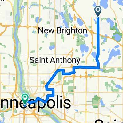
- Highway 96 to northoaks- 15.8 mi
- Distance
- 25.7 km
- Ascent
- 125 m
- Descent
- 124 m
- Location
- Shoreview, Minnesota, United States of America
Open it in the app