

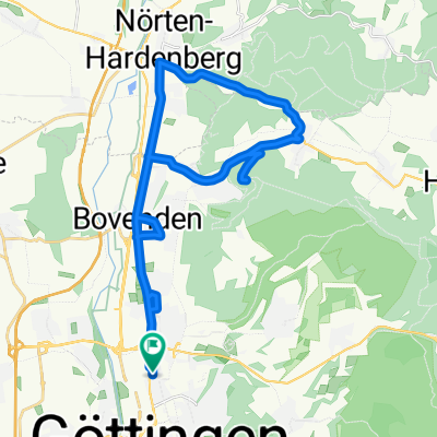
Göttingen -> Moringen -> Dassel -> Göttingen
A cycling route starting in Göttingen, Lower Saxony, Germany.
Overview
About this route
just over 600 HM, undulating but not too demanding, hills depending on the wind direction and training form for "pushing through" or also suitable for KA. Before the return, you can also take some rounds between Bovenden and Parensen as desired to possibly add more kilometers (loop via agricultural path and then back to Parensen via Bovender Str. and back to Bovenden via LWWeg and so on). Since the route input does not work correctly, I had to enter the detour via Thüdingshausen for the return. But you can also take the same way back from Moringen as you did on the way there.
- -:--
- Duration
- 87.9 km
- Distance
- 509 m
- Ascent
- 519 m
- Descent
- ---
- Avg. speed
- 290 m
- Max. altitude
Route quality
Waytypes & surfaces along the route
Waytypes
Road
26.4 km
(30 %)
Quiet road
10.6 km
(12 %)
Surfaces
Paved
67.7 km
(77 %)
Unpaved
1.8 km
(2 %)
Asphalt
66 km
(75 %)
Paved (undefined)
1.8 km
(2 %)
Continue with Bikemap
Use, edit, or download this cycling route
You would like to ride Göttingen -> Moringen -> Dassel -> Göttingen or customize it for your own trip? Here is what you can do with this Bikemap route:
Free features
- Save this route as favorite or in collections
- Copy & plan your own version of this route
- Split it into stages to create a multi-day tour
- Sync your route with Garmin or Wahoo
Premium features
Free trial for 3 days, or one-time payment. More about Bikemap Premium.
- Navigate this route on iOS & Android
- Export a GPX / KML file of this route
- Create your custom printout (try it for free)
- Download this route for offline navigation
Discover more Premium features.
Get Bikemap PremiumFrom our community
Other popular routes starting in Göttingen
 Göttingen Skizze Tour d´Énergie 2009
- Distance
- 87.8 km
- Ascent
- 1,028 m
- Descent
- 1,031 m
- Location
- Göttingen, Lower Saxony, Germany
 Tour d'Energie 2008
- Distance
- 84.7 km
- Ascent
- 944 m
- Descent
- 855 m
- Location
- Göttingen, Lower Saxony, Germany
 Tour d'Energie 2012 - 46 km
- Distance
- 47.5 km
- Ascent
- 475 m
- Descent
- 469 m
- Location
- Göttingen, Lower Saxony, Germany
 Gö-HaMü-KS-Witzhs-Gö
- Distance
- 130.5 km
- Ascent
- 1,028 m
- Descent
- 948 m
- Location
- Göttingen, Lower Saxony, Germany
 GÖ-Eichenberg-GÖ
- Distance
- 43.7 km
- Ascent
- 186 m
- Descent
- 186 m
- Location
- Göttingen, Lower Saxony, Germany
 Gö-Wald 17.11.19
- Distance
- 33.2 km
- Ascent
- 325 m
- Descent
- 325 m
- Location
- Göttingen, Lower Saxony, Germany
 Plesserunde
- Distance
- 28.3 km
- Ascent
- 392 m
- Descent
- 372 m
- Location
- Göttingen, Lower Saxony, Germany
 Thüringisches Eichsfeld von Göttingen
- Distance
- 96.7 km
- Ascent
- 957 m
- Descent
- 910 m
- Location
- Göttingen, Lower Saxony, Germany
Open it in the app