

The Profs Dirty Dozen of Climbs
A cycling route starting in Mulgrave, Victoria, Australia.
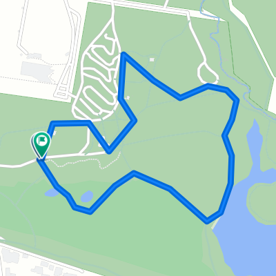
Overview
About this route
-
Taylor Lane north
-
Blackwood Park (Bruce's Hill)
-
Ormonde Rd (Col d' maitre de remorquage)
-
Forest Road north
-
Old Forest Road / Toorak Avenue
-
Inverness Avenue
-
l'alpe du 1 in 20
-
Perrins Creek
-
Olinda Crescent
-
Ridge Road to the Summit / Lookout
-
Mt Danenong tourist Road to Olinda
-
Taylors Lane Sprint south.
- -:--
- Duration
- 67.7 km
- Distance
- 886 m
- Ascent
- 886 m
- Descent
- ---
- Avg. speed
- ---
- Max. altitude
Route quality
Waytypes & surfaces along the route
Waytypes
Cycleway
14.9 km
(22 %)
Quiet road
13.5 km
(20 %)
Surfaces
Paved
50.7 km
(75 %)
Asphalt
41.3 km
(61 %)
Paved (undefined)
6.1 km
(9 %)
Continue with Bikemap
Use, edit, or download this cycling route
You would like to ride The Profs Dirty Dozen of Climbs or customize it for your own trip? Here is what you can do with this Bikemap route:
Free features
- Save this route as favorite or in collections
- Copy & plan your own version of this route
- Sync your route with Garmin or Wahoo
Premium features
Free trial for 3 days, or one-time payment. More about Bikemap Premium.
- Navigate this route on iOS & Android
- Export a GPX / KML file of this route
- Create your custom printout (try it for free)
- Download this route for offline navigation
Discover more Premium features.
Get Bikemap PremiumFrom our community
Other popular routes starting in Mulgrave
 Eastlink, Rowville to 9 Laggan Court, Endeavour Hills
- Distance
- 14.7 km
- Ascent
- 79 m
- Descent
- 72 m
- Location
- Mulgrave, Victoria, Australia
 Paul's Mulgrave to Donna Buang Odyssey
- Distance
- 182.2 km
- Ascent
- 2,001 m
- Descent
- 2,001 m
- Location
- Mulgrave, Victoria, Australia
 Proposed Saturday Ride
- Distance
- 75.5 km
- Ascent
- 942 m
- Descent
- 942 m
- Location
- Mulgrave, Victoria, Australia
 3 peaks training ride - Mulgrave Yellingbo
- Distance
- 107.5 km
- Ascent
- 1,310 m
- Descent
- 1,310 m
- Location
- Mulgrave, Victoria, Australia
 Work
Work- Distance
- 13.1 km
- Ascent
- 0 m
- Descent
- 0 m
- Location
- Mulgrave, Victoria, Australia
 Wheelers hill to Dandenong Bypass and back
- Distance
- 24.4 km
- Ascent
- 93 m
- Descent
- 103 m
- Location
- Mulgrave, Victoria, Australia
 Ride through Melbourne's south-east
- Distance
- 41.8 km
- Ascent
- 113 m
- Descent
- 112 m
- Location
- Mulgrave, Victoria, Australia
 Jynx
Jynx- Distance
- 2.3 km
- Ascent
- 36 m
- Descent
- 36 m
- Location
- Mulgrave, Victoria, Australia
Open it in the app