

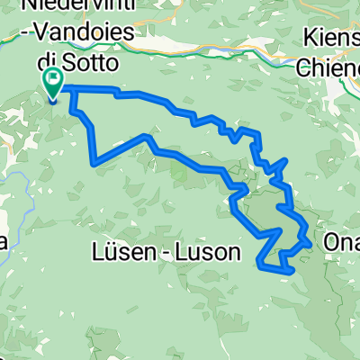
Td98_6.den Rio de Pusteria - Aprica
A cycling route starting in Rodeneck-Rodengo, Trentino-Alto Adige, Italy.
Overview
About this route
- -:--
- Duration
- 201.8 km
- Distance
- 1,971 m
- Ascent
- 1,911 m
- Descent
- ---
- Avg. speed
- ---
- Avg. speed
Continue with Bikemap
Use, edit, or download this cycling route
You would like to ride Td98_6.den Rio de Pusteria - Aprica or customize it for your own trip? Here is what you can do with this Bikemap route:
Free features
- Save this route as favorite or in collections
- Copy & plan your own version of this route
- Split it into stages to create a multi-day tour
- Sync your route with Garmin or Wahoo
Premium features
Free trial for 3 days, or one-time payment. More about Bikemap Premium.
- Navigate this route on iOS & Android
- Export a GPX / KML file of this route
- Create your custom printout (try it for free)
- Download this route for offline navigation
Discover more Premium features.
Get Bikemap PremiumFrom our community
Other popular routes starting in Rodeneck-Rodengo
 Pustertaler Straße, Vintl nach Michael-Pacher-Straße 2, Bruneck
- Distance
- 23.6 km
- Ascent
- 540 m
- Descent
- 298 m
- Location
- Rodeneck-Rodengo, Trentino-Alto Adige, Italy
 Td98_ 12.den Rio de Pusteria - Saalfenden am Steinemen Meer
- Distance
- 195 km
- Ascent
- 2,700 m
- Descent
- 2,694 m
- Location
- Rodeneck-Rodengo, Trentino-Alto Adige, Italy
 Tour A4
- Distance
- 41.2 km
- Ascent
- 974 m
- Descent
- 752 m
- Location
- Rodeneck-Rodengo, Trentino-Alto Adige, Italy
 4. Etape Haslach Feltre
- Distance
- 187.4 km
- Ascent
- 858 m
- Descent
- 1,333 m
- Location
- Rodeneck-Rodengo, Trentino-Alto Adige, Italy
 Via Val Pusteria, Rio di Pusteria to Via Nikolaus 5, Naz-Sciaves
- Distance
- 8.2 km
- Ascent
- 1,017 m
- Descent
- 1,016 m
- Location
- Rodeneck-Rodengo, Trentino-Alto Adige, Italy
 Td98_6.den Rio de Pusteria - Aprica
- Distance
- 201.8 km
- Ascent
- 1,971 m
- Descent
- 1,911 m
- Location
- Rodeneck-Rodengo, Trentino-Alto Adige, Italy
 Rodenecker-Alm-Runde
- Distance
- 35.5 km
- Ascent
- 982 m
- Descent
- 982 m
- Location
- Rodeneck-Rodengo, Trentino-Alto Adige, Italy
 Verso L'alpe di Rodengo
- Distance
- 2.5 km
- Ascent
- 267 m
- Descent
- 7 m
- Location
- Rodeneck-Rodengo, Trentino-Alto Adige, Italy
Open it in the app