Minigolf-Runde
- 19 km
- 26 m
- 29 m
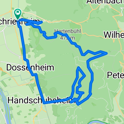
- Schriesheim, Baden-Wurttemberg, Germany
A cycling route starting in Schriesheim, Baden-Wurttemberg, Germany.
Overview
Route quality
Road
16.7 km
(32 %)
Quiet road
2.1 km
(4 %)
Paved
50.6 km
(97 %)
Asphalt
50.6 km
(97 %)
Undefined
1.6 km
(3 %)
Route highlights
Continue with Bikemap
You would like to ride HD Heiligenberg + Königsstuhl or customize it for your own trip? Here is what you can do with this Bikemap route:
Free trial for 3 days, or one-time payment. More about Bikemap Premium.
Discover more Premium features.
Get Bikemap PremiumFrom our community
Open it in the app