

Zum Baden im Sechlinsee
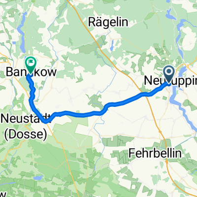
A cycling route starting in Neuruppin, Brandenburg, Germany.
Overview
About this route
Neuruppin > Zippelsförde > Rheinsberg > Stechlinsee > Fürstenberg/Havel
- -:--
- Duration
- 62.6 km
- Distance
- 185 m
- Ascent
- 169 m
- Descent
- ---
- Avg. speed
- ---
- Max. altitude
Route quality
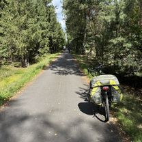
Waytypes & surfaces along the route
Waytypes
Path
26.9 km
(43 %)
Quiet road
12.5 km
(20 %)
Surfaces
Paved
47.6 km
(76 %)
Unpaved
6.9 km
(11 %)
Asphalt
46.3 km
(74 %)
Ground
3.1 km
(5 %)
Route highlights
Points of interest along the route
Point of interest after 1.1 km
http://www.reiseland-brandenburg.de/reiseziele/ruppiner-land/details/id/355/theme/a-z.html
Point of interest after 1.8 km
Fontane Denkmal
Point of interest after 2.2 km
Fontanes Geburtshaus
Continue with Bikemap
Use, edit, or download this cycling route
You would like to ride Zum Baden im Sechlinsee or customize it for your own trip? Here is what you can do with this Bikemap route:
Free features
- Save this route as favorite or in collections
- Copy & plan your own version of this route
- Sync your route with Garmin or Wahoo
Premium features
Free trial for 3 days, or one-time payment. More about Bikemap Premium.
- Navigate this route on iOS & Android
- Export a GPX / KML file of this route
- Create your custom printout (try it for free)
- Download this route for offline navigation
Discover more Premium features.
Get Bikemap PremiumFrom our community
Other popular routes starting in Neuruppin
 Ruppiner See
- Distance
- 40.5 km
- Ascent
- 202 m
- Descent
- 248 m
- Location
- Neuruppin, Brandenburg, Germany
 Neuruppin - Ribnitz-Damgarten
- Distance
- 184.8 km
- Ascent
- 282 m
- Descent
- 320 m
- Location
- Neuruppin, Brandenburg, Germany
 Friedrich-Engels-Straße, Neuruppin nach Fritz-Reuter-Straße, Rechlin
- Distance
- 58.4 km
- Ascent
- 601 m
- Descent
- 576 m
- Location
- Neuruppin, Brandenburg, Germany
 Zum Baden im Sechlinsee
- Distance
- 62.6 km
- Ascent
- 185 m
- Descent
- 169 m
- Location
- Neuruppin, Brandenburg, Germany
 Neuruppin Rheinsberger Tor nach Heegeseeweg
- Distance
- 40.3 km
- Ascent
- 286 m
- Descent
- 261 m
- Location
- Neuruppin, Brandenburg, Germany
 Rheinsberg und Ruppiner Schweiz
- Distance
- 85.3 km
- Ascent
- 253 m
- Descent
- 253 m
- Location
- Neuruppin, Brandenburg, Germany
 TOUR DE RHIN I
- Distance
- 132.2 km
- Ascent
- 136 m
- Descent
- 144 m
- Location
- Neuruppin, Brandenburg, Germany
 Von Neuruppin bis Wusterhausen/Dosse
- Distance
- 33.7 km
- Ascent
- 37 m
- Descent
- 44 m
- Location
- Neuruppin, Brandenburg, Germany
Open it in the app