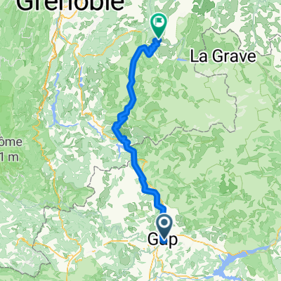
Tour 2013 - Etapa 18: Gap - L'Alpe-d'Huez (Recorrido Alternativo)
- 187.4 km
- 4,870 m
- 3,832 m
- Gap, Provence-Alpes-Côte d'Azur Region, France
A cycling route starting in Gap, Provence-Alpes-Côte d'Azur Region, France.
Overview
Tour de France 2013 - on Thu, 18.07. | 17th | 19th Stage 18 covering 168 km as a high mountain stagefrom Gap to L'Alpe-d'Huez
The exact route will be published by the organizers only in June 2013.
all stages of the Tour de France 2013: 01 - 02 - 03 - 04 - 05 - 06 - 07 - 08 - 09 - 10 - 11 - 12 - 13 - 14 - 15 - 16 - 17 - 18 - 19 - 20 - 21
created this 13 years ago
Route quality
Road
60 km
(32 %)
Track
20.6 km
(11 %)
Paved
84.3 km
(45 %)
Unpaved
18.7 km
(10 %)
Asphalt
82.4 km
(44 %)
Unpaved (undefined)
9.4 km
(5 %)
Continue with Bikemap
You would like to ride Tour 2013 - Etapa 18: Gap - L'Alpe-d'Huez (Recorrido Alternativo) or customize it for your own trip? Here is what you can do with this Bikemap route:
Free trial for 3 days, or one-time payment. More about Bikemap Premium.
Discover more Premium features.
Get Bikemap PremiumFrom our community
Open it in the app