

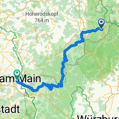
Rhön Runde mit dem MTB
A cycling route starting in Poppenhausen, Hesse, Germany.
Overview
About this route
Also mein Fall war die Tour nicht wirklich.
Zwischendrin gibt es eine extra präparierte MTB Abfahrt. Ich bin die aber aus Versehen falsch herum gefahren :) Wem solche Schanzen Abfahren Spaß machen, kommt da voll auf seine Kosten. Bitte die Karten genau ansehen und die Richtung beachten!- -:--
- Duration
- 83.3 km
- Distance
- 1,734 m
- Ascent
- 1,734 m
- Descent
- ---
- Avg. speed
- ---
- Max. altitude

Route quality
Waytypes & surfaces along the route
Waytypes
Track
42.7 km
(51 %)
Quiet road
16.8 km
(20 %)
Surfaces
Paved
39.8 km
(48 %)
Unpaved
38.2 km
(46 %)
Asphalt
35.5 km
(43 %)
Ground
14.9 km
(18 %)
Continue with Bikemap
Use, edit, or download this cycling route
You would like to ride Rhön Runde mit dem MTB or customize it for your own trip? Here is what you can do with this Bikemap route:
Free features
- Save this route as favorite or in collections
- Copy & plan your own version of this route
- Split it into stages to create a multi-day tour
- Sync your route with Garmin or Wahoo
Premium features
Free trial for 3 days, or one-time payment. More about Bikemap Premium.
- Navigate this route on iOS & Android
- Export a GPX / KML file of this route
- Create your custom printout (try it for free)
- Download this route for offline navigation
Discover more Premium features.
Get Bikemap PremiumFrom our community
Other popular routes starting in Poppenhausen
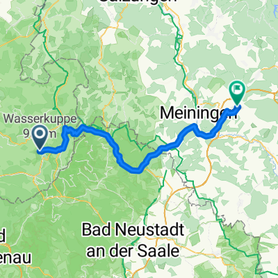
 WP RR Wasserkuppe - Fürth
- Distance
- 221.2 km
- Ascent
- 1,563 m
- Descent
- 2,187 m
- Location
- Poppenhausen, Hesse, Germany
 Wasserkuppe-Hanau
- Distance
- 158.2 km
- Ascent
- 1,296 m
- Descent
- 2,104 m
- Location
- Poppenhausen, Hesse, Germany
 Wasserkuppe-Thaiden-Birx-Ostheim-Dillstädt (Heimweg)
- Distance
- 67.9 km
- Ascent
- 541 m
- Descent
- 1,093 m
- Location
- Poppenhausen, Hesse, Germany
 Poppenhausen-Milseburg-Runde
- Distance
- 60.8 km
- Ascent
- 857 m
- Descent
- 857 m
- Location
- Poppenhausen, Hesse, Germany
 Route 1 von Poppenhausen (Wasserkuppe)
- Distance
- 34.4 km
- Ascent
- 481 m
- Descent
- 482 m
- Location
- Poppenhausen, Hesse, Germany
 Felix und Vincents MTB Strecke von der Steinwand nach Hofbieber
- Distance
- 13.5 km
- Ascent
- 193 m
- Descent
- 399 m
- Location
- Poppenhausen, Hesse, Germany
 Haunetalradweg - von der Quelle zur Nüst-Mündung
- Distance
- 26.3 km
- Ascent
- 77 m
- Descent
- 284 m
- Location
- Poppenhausen, Hesse, Germany
 Burgruine Ebersburg - Hohe Hölle - Kreuzberg - Burgruine Ebersburg
- Distance
- 51.5 km
- Ascent
- 1,159 m
- Descent
- 1,159 m
- Location
- Poppenhausen, Hesse, Germany
Open it in the app