Granada - Llano de la Perdiz - Sacromonte
A cycling route starting in Granada, Andalusia, Spain.
Overview
About this route
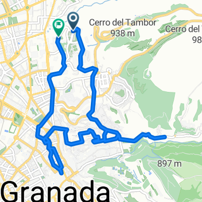
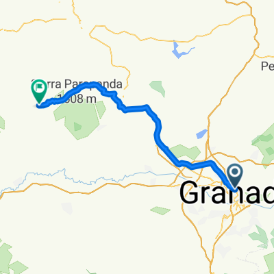
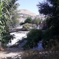
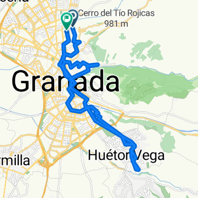
Route between Granada and Llano de la Perdiz, ascending by the cemetery and descending by the Sacromonte.* Route overview. Granada - Llano de la Perdiz.* What is special about it? You have to cross a river.* Why do you recommend it? It's easy and very close to Granada.* What are its characteristics? Relatively easy and lots of fun.* Etc.
- -:--
- Duration
- 19.9 km
- Distance
- 379 m
- Ascent
- 378 m
- Descent
- ---
- Avg. speed
- ---
- Max. altitude
Route quality
Waytypes & surfaces along the route
Waytypes
Track
10 km
(50 %)
Quiet road
4 km
(20 %)
Surfaces
Paved
9.8 km
(49 %)
Unpaved
9.6 km
(48 %)
Asphalt
7.4 km
(37 %)
Unpaved (undefined)
6.2 km
(31 %)
Continue with Bikemap
Use, edit, or download this cycling route
You would like to ride Granada - Llano de la Perdiz - Sacromonte or customize it for your own trip? Here is what you can do with this Bikemap route:
Free features
- Save this route as favorite or in collections
- Copy & plan your own version of this route
- Sync your route with Garmin or Wahoo
Premium features
Free trial for 3 days, or one-time payment. More about Bikemap Premium.
- Navigate this route on iOS & Android
- Export a GPX / KML file of this route
- Create your custom printout (try it for free)
- Download this route for offline navigation
Discover more Premium features.
Get Bikemap PremiumFrom our community
Other popular routes starting in Granada
- Ruta Turuta - Horacio Claudio Houseman Morlengo
- Distance
- 58.9 km
- Ascent
- ---
- Descent
- ---
- Location
- Granada, Andalusia, Spain
- Granada - Guejar Sierra
- Distance
- 17.9 km
- Ascent
- 534 m
- Descent
- 146 m
- Location
- Granada, Andalusia, Spain
- Puente verde-Cenes-Pinos Genil-Pantano de Canales
- Distance
- 23.9 km
- Ascent
- 311 m
- Descent
- 310 m
- Location
- Granada, Andalusia, Spain
- Calle Joaquina Eguaras, Granada a Calle Gobernador Pedro Temboury, Granada
- Distance
- 19.3 km
- Ascent
- 117 m
- Descent
- 117 m
- Location
- Granada, Andalusia, Spain
- Vuelta al llano
- Distance
- 7.7 km
- Ascent
- 190 m
- Descent
- 188 m
- Location
- Granada, Andalusia, Spain
- El Chorrillo
- Distance
- 63.9 km
- Ascent
- 1,039 m
- Descent
- 1,036 m
- Location
- Granada, Andalusia, Spain
- Granada - Barcelona - por los montes
- Distance
- 1,260.2 km
- Ascent
- 4,578 m
- Descent
- 5,247 m
- Location
- Granada, Andalusia, Spain
- Granada (Puente Verde-Llano de la Perdíz)
- Distance
- 8.4 km
- Ascent
- 420 m
- Descent
- 86 m
- Location
- Granada, Andalusia, Spain
Open it in the app