Vormittagsprogramm
- 17.9 km
- 152 m
- 154 m
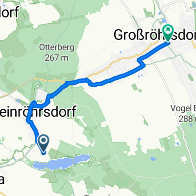
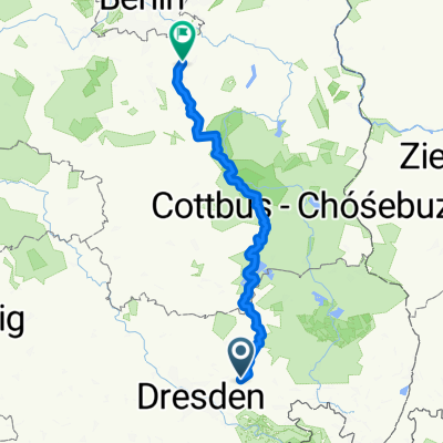
- Arnsdorf, Saxony, Germany
A cycling route starting in Arnsdorf, Saxony, Germany.
Overview
beautiful circular tour with several viewpoints, ride through the Hütter valley and a detour to the reservoir in Wallroda
created this 12 years ago
Route quality
Road
5.9 km
(24 %)
Quiet road
5.4 km
(22 %)
Paved
16.1 km
(66 %)
Unpaved
2.9 km
(12 %)
Asphalt
13 km
(53 %)
Concrete
2.9 km
(12 %)
Route highlights
schöner Rundblick mit idealer Wiese zum Drachen steigen lassen
schönes Freibad
Schloß Klippenstein, ein Besuch wert
Hüttermühle, bei schönen WE-Wetter Imbis offen
schöner Picknickplatz
schöne Gasststätte mit Minigolf und SUPER-Camping-Platz
schöner Rundblick bis ins Elbtal bzw. Sächs. Schweiz
Continue with Bikemap
You would like to ride Rundweg Arnsdorf-Radeberg-Stausee Wallroda or customize it for your own trip? Here is what you can do with this Bikemap route:
Free trial for 3 days, or one-time payment. More about Bikemap Premium.
Discover more Premium features.
Get Bikemap PremiumFrom our community
Open it in the app