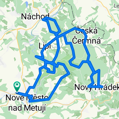
bajková Borová
- 26.3 km
- 684 m
- 681 m
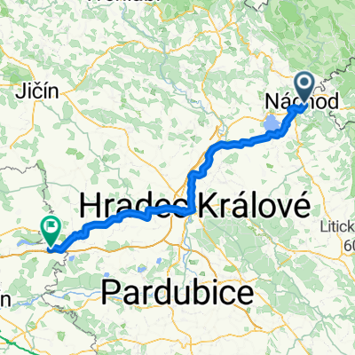
- Náchod, Královéhradecký kraj, Czechia
A cycling route starting in Náchod, Královéhradecký kraj, Czechia.
Overview
jaromer turnov
created this 12 years ago
Route quality
Road
89.7 km
(52 %)
Quiet road
29.3 km
(17 %)
Paved
82.8 km
(48 %)
Unpaved
13.8 km
(8 %)
Asphalt
77.6 km
(45 %)
Ground
6.9 km
(4 %)
Route highlights


Continue with Bikemap
You would like to ride jaromer turnov or customize it for your own trip? Here is what you can do with this Bikemap route:
Free trial for 3 days, or one-time payment. More about Bikemap Premium.
Discover more Premium features.
Get Bikemap PremiumFrom our community
Open it in the app