

jgjgh
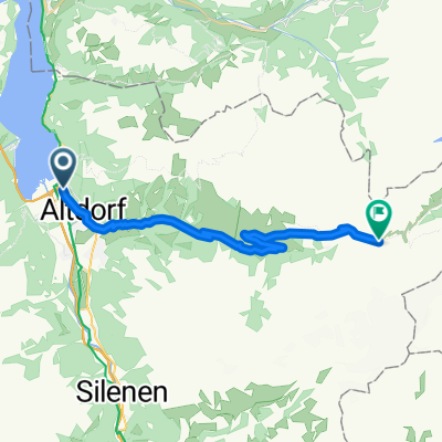
A cycling route starting in Flüelen, Canton of Uri, Switzerland.
Overview
About this route
- -:--
- Duration
- 206.2 km
- Distance
- 5,980 m
- Ascent
- 4,656 m
- Descent
- ---
- Avg. speed
- ---
- Max. altitude

Route quality
Waytypes & surfaces along the route
Waytypes
Track
12.4 km
(6 %)
Quiet road
8.2 km
(4 %)
Surfaces
Paved
187.6 km
(91 %)
Unpaved
10.3 km
(5 %)
Asphalt
185.6 km
(90 %)
Unpaved (undefined)
8.2 km
(4 %)
Route highlights
Points of interest along the route
Point of interest after 13.2 km
Davos 1560 m
Point of interest after 14.3 km
SAINT-MORITZ 1856m
Point of interest after 72.8 km
GSTAAD 950m
Point of interest after 195 km
Crans Montana 1500m
Point of interest after 195 km
VERBIER 1500m
Point of interest after 195 km
ZERMATT 1620m
Continue with Bikemap
Use, edit, or download this cycling route
You would like to ride jgjgh or customize it for your own trip? Here is what you can do with this Bikemap route:
Free features
- Save this route as favorite or in collections
- Copy & plan your own version of this route
- Split it into stages to create a multi-day tour
- Sync your route with Garmin or Wahoo
Premium features
Free trial for 3 days, or one-time payment. More about Bikemap Premium.
- Navigate this route on iOS & Android
- Export a GPX / KML file of this route
- Create your custom printout (try it for free)
- Download this route for offline navigation
Discover more Premium features.
Get Bikemap PremiumFrom our community
Other popular routes starting in Flüelen
 Fluen to Erstfeld
- Distance
- 12 km
- Ascent
- 66 m
- Descent
- 27 m
- Location
- Flüelen, Canton of Uri, Switzerland
 Vierwaldstättersee
- Distance
- 51.4 km
- Ascent
- 940 m
- Descent
- 932 m
- Location
- Flüelen, Canton of Uri, Switzerland
 Flüelen_Camping-Golzernsee_Rundtour
- Distance
- 61.1 km
- Ascent
- 0 m
- Descent
- 0 m
- Location
- Flüelen, Canton of Uri, Switzerland
 Svájc - 7. nap
- Distance
- 90.2 km
- Ascent
- 1,831 m
- Descent
- 1,843 m
- Location
- Flüelen, Canton of Uri, Switzerland
 jgjgh
jgjgh- Distance
- 206.2 km
- Ascent
- 5,980 m
- Descent
- 4,656 m
- Location
- Flüelen, Canton of Uri, Switzerland
 Flüelen - Klausenpass - Klöntal - Flüelen
- Distance
- 129.8 km
- Ascent
- 2,679 m
- Descent
- 2,681 m
- Location
- Flüelen, Canton of Uri, Switzerland
 EV5: Flüelen to Bauen
- Distance
- 4.6 km
- Ascent
- 222 m
- Descent
- 184 m
- Location
- Flüelen, Canton of Uri, Switzerland
 Klausenpass Westseite
- Distance
- 26.8 km
- Ascent
- 1,626 m
- Descent
- 101 m
- Location
- Flüelen, Canton of Uri, Switzerland
Open it in the app