

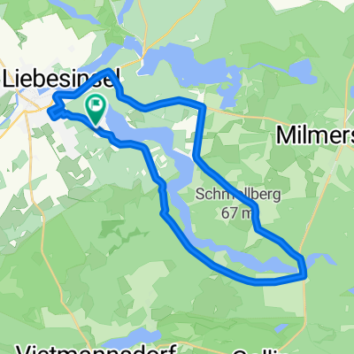
Templin-Boitzenburg-Prenzlau
A cycling route starting in Templin, Brandenburg, Germany.
Overview
About this route
- -:--
- Duration
- 41.6 km
- Distance
- 183 m
- Ascent
- 209 m
- Descent
- ---
- Avg. speed
- 111 m
- Max. altitude
Route quality
Waytypes & surfaces along the route
Waytypes
Busy road
20.4 km
(49 %)
Pedestrian area
8.8 km
(21 %)
Surfaces
Paved
32.9 km
(79 %)
Unpaved
3.1 km
(7 %)
Asphalt
25.3 km
(61 %)
Paving stones
6.4 km
(15 %)
Continue with Bikemap
Use, edit, or download this cycling route
You would like to ride Templin-Boitzenburg-Prenzlau or customize it for your own trip? Here is what you can do with this Bikemap route:
Free features
- Save this route as favorite or in collections
- Copy & plan your own version of this route
- Sync your route with Garmin or Wahoo
Premium features
Free trial for 3 days, or one-time payment. More about Bikemap Premium.
- Navigate this route on iOS & Android
- Export a GPX / KML file of this route
- Create your custom printout (try it for free)
- Download this route for offline navigation
Discover more Premium features.
Get Bikemap PremiumFrom our community
Other popular routes starting in Templin
 53 km Templin
- Distance
- 57.9 km
- Ascent
- 167 m
- Descent
- 169 m
- Location
- Templin, Brandenburg, Germany
 63 Km Templin
- Distance
- 62.6 km
- Ascent
- 187 m
- Descent
- 187 m
- Location
- Templin, Brandenburg, Germany
 U6 Uckermark: Lindenhof-Annenwalde-Templin
- Distance
- 30 km
- Ascent
- 164 m
- Descent
- 165 m
- Location
- Templin, Brandenburg, Germany
 Um den Lübbesee (2)
- Distance
- 23.1 km
- Ascent
- 154 m
- Descent
- 150 m
- Location
- Templin, Brandenburg, Germany
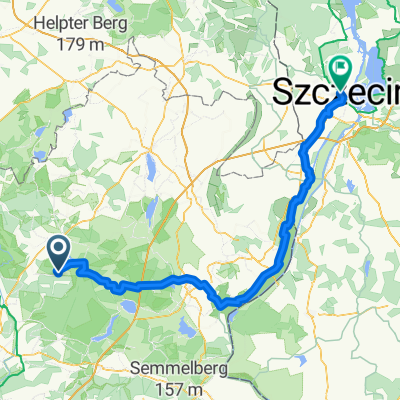 シュチェチン ルート
- Distance
- 127.2 km
- Ascent
- 596 m
- Descent
- 624 m
- Location
- Templin, Brandenburg, Germany
 Templin-Boitzenburg-Prenzlau
- Distance
- 41.6 km
- Ascent
- 183 m
- Descent
- 209 m
- Location
- Templin, Brandenburg, Germany
 Tour 2020 - Tag 1
- Distance
- 100 km
- Ascent
- 126 m
- Descent
- 150 m
- Location
- Templin, Brandenburg, Germany
 Lange Radrunde vom 10. Mai 09:30
- Distance
- 85.1 km
- Ascent
- 215 m
- Descent
- 201 m
- Location
- Templin, Brandenburg, Germany
Open it in the app