

20130629-Schauinslandtour 80 Km
A cycling route starting in Unterkrozingen, Baden-Württemberg, Germany.
Overview
About this route
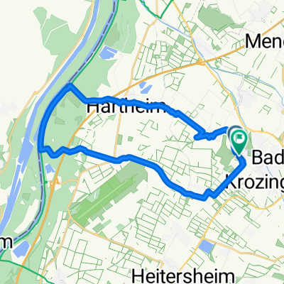
Bad Krozingen-Münstertal im Schwarzwald-Wieden-Aftersteg-Muggenbrunn-Schauinsland-Horben-Wittnau-Sülden-Bollschweil-Ehrenkirchen-Bad Krozingen
- -:--
- Duration
- 79.1 km
- Distance
- 1,512 m
- Ascent
- 1,512 m
- Descent
- ---
- Avg. speed
- ---
- Max. altitude

Route quality
Waytypes & surfaces along the route
Waytypes
Busy road
41.1 km
(52 %)
Path
11.8 km
(15 %)
Surfaces
Paved
66.4 km
(84 %)
Unpaved
6 km
(8 %)
Asphalt
62.9 km
(79 %)
Gravel
4.5 km
(6 %)
Continue with Bikemap
Use, edit, or download this cycling route
You would like to ride 20130629-Schauinslandtour 80 Km or customize it for your own trip? Here is what you can do with this Bikemap route:
Free features
- Save this route as favorite or in collections
- Copy & plan your own version of this route
- Sync your route with Garmin or Wahoo
Premium features
Free trial for 3 days, or one-time payment. More about Bikemap Premium.
- Navigate this route on iOS & Android
- Export a GPX / KML file of this route
- Create your custom printout (try it for free)
- Download this route for offline navigation
Discover more Premium features.
Get Bikemap PremiumFrom our community
Other popular routes starting in Unterkrozingen
 20130629-Schauinslandtour 80 Km
- Distance
- 79.1 km
- Ascent
- 1,512 m
- Descent
- 1,512 m
- Location
- Unterkrozingen, Baden-Württemberg, Germany
 Rheintour
- Distance
- 22.3 km
- Ascent
- 32 m
- Descent
- 36 m
- Location
- Unterkrozingen, Baden-Württemberg, Germany
 Bad Krozingen Rhein
- Distance
- 22.3 km
- Ascent
- 44 m
- Descent
- 46 m
- Location
- Unterkrozingen, Baden-Württemberg, Germany
 Bad Krozingen - RR 01 - Kaiserstuhl&Markgräflerland
- Distance
- 89.2 km
- Ascent
- 520 m
- Descent
- 518 m
- Location
- Unterkrozingen, Baden-Württemberg, Germany
 Bad Krozingen Breisach Bad Krozingen
- Distance
- 38.1 km
- Ascent
- 51 m
- Descent
- 53 m
- Location
- Unterkrozingen, Baden-Württemberg, Germany
 Josef-Mühlebach-Straße 5D, Bad Krozingen nach Colombistraße 15, Freiburg im Breisgau
- Distance
- 20.3 km
- Ascent
- 135 m
- Descent
- 72 m
- Location
- Unterkrozingen, Baden-Württemberg, Germany
 Römerradweg Oberrhein Tag 1 (Badenweiler)
- Distance
- 51.8 km
- Ascent
- 445 m
- Descent
- 445 m
- Location
- Unterkrozingen, Baden-Württemberg, Germany
 Belchen hoch drei 2013
- Distance
- 236 km
- Ascent
- 3,233 m
- Descent
- 2,108 m
- Location
- Unterkrozingen, Baden-Württemberg, Germany
Open it in the app