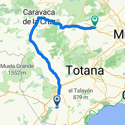
Puerto Lumbreras - Albudeite
- 115.2 km
- 450 m
- 591 m
- Puerto Lumbreras, Murcia, Spain
A cycling route starting in Puerto Lumbreras, Murcia, Spain.
Overview
PUERTO LUMBRERAS-RAMBLA DE NOGALTE-RAMBLA DE PALLARESES-CUESTA DEL MELLADO-ALTO DE LOS JORDANES (655 M)-LOS CASAREJOS-RAMBLA DE LOS CASAREJOS-LA ATALAYA-LA CUMBRE (855 M)-CTRA LAS MACETAS-COLLADO DE LOS MIRAVETES (920 M)-BARRANCO DE LOS BUITRAGOS-VIA SERVICIO AUTOVIA-VENTA LA PETRA-LAS MINAS-ALTO DEL AVE (868 M)-BARRANCO DE LA FRAGUA-RAMBLA DE NOGALTE-PUERTO LUMBRERAS.
created this 12 years ago
Continue with Bikemap
You would like to ride RUTA MTB BÉJAR-ZARZALICO or customize it for your own trip? Here is what you can do with this Bikemap route:
Free trial for 3 days, or one-time payment. More about Bikemap Premium.
Discover more Premium features.
Get Bikemap PremiumFrom our community
Open it in the app