

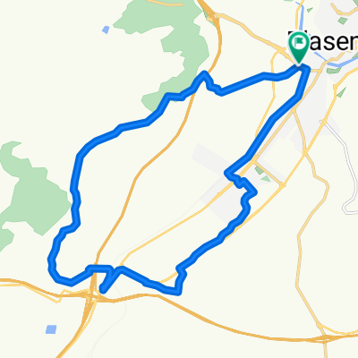
Plasencia - Embalse de Torrejón (Monfragüe)
A cycling route starting in Plasencia, Extremadura, Spain.
Overview
About this route
Nivel Bajo - Medio
La ruta es muy bonita, transcurre por dehesas y el Parque Nacional de Monfragüe, tiene la subida al Puerto de la Serrana como único accidente reseñable. En los últimos 5 Km se rueda por caminos de trialeras en los que probablemente tengais que poner pie a tierra especialemente del 31 al 33.
- -:--
- Duration
- 34 km
- Distance
- 438 m
- Ascent
- 539 m
- Descent
- ---
- Avg. speed
- ---
- Max. altitude

Route highlights
Points of interest along the route
Point of interest after 24.8 km
Inicio subida, rampas de duras.
Point of interest after 25.3 km
Puerto de la serrana
Continue with Bikemap
Use, edit, or download this cycling route
You would like to ride Plasencia - Embalse de Torrejón (Monfragüe) or customize it for your own trip? Here is what you can do with this Bikemap route:
Free features
- Save this route as favorite or in collections
- Copy & plan your own version of this route
- Sync your route with Garmin or Wahoo
Premium features
Free trial for 3 days, or one-time payment. More about Bikemap Premium.
- Navigate this route on iOS & Android
- Export a GPX / KML file of this route
- Create your custom printout (try it for free)
- Download this route for offline navigation
Discover more Premium features.
Get Bikemap PremiumFrom our community
Other popular routes starting in Plasencia
 Vuelta al Pantano del Jerte
- Distance
- 41.1 km
- Ascent
- 363 m
- Descent
- 362 m
- Location
- Plasencia, Extremadura, Spain
 Plasencia - Embalse de Torrejón (Monfragüe)
- Distance
- 34 km
- Ascent
- 438 m
- Descent
- 539 m
- Location
- Plasencia, Extremadura, Spain
 Vuelta al Merengue
- Distance
- 19.8 km
- Ascent
- 395 m
- Descent
- 390 m
- Location
- Plasencia, Extremadura, Spain
 Subida a la Ermita
- Distance
- 16.2 km
- Ascent
- 365 m
- Descent
- 369 m
- Location
- Plasencia, Extremadura, Spain
 Gredos y Peña de Francia 2013
- Distance
- 621.8 km
- Ascent
- 3,763 m
- Descent
- 3,763 m
- Location
- Plasencia, Extremadura, Spain
 2 Cáceres Salamanca
- Distance
- 100 km
- Ascent
- 1,229 m
- Descent
- 1,236 m
- Location
- Plasencia, Extremadura, Spain
 Puertos del Valle
- Distance
- 215.3 km
- Ascent
- 4,617 m
- Descent
- 2,995 m
- Location
- Plasencia, Extremadura, Spain
 2008 (Exursión - Plasencia)
- Distance
- 90.9 km
- Ascent
- 1,321 m
- Descent
- 1,326 m
- Location
- Plasencia, Extremadura, Spain
Open it in the app