Friedenau-Grunewaldturm-Friedenau
A cycling route starting in Friedenau, State of Berlin, Germany.
Overview
About this route
The tour was a beautiful circular route with the intermediate goal of the 'Grundwald Tower', which was unfortunately covered due to restoration. The climb to the tower is certainly not for everyone. Here, you see more people pushing their bikes than riding. Hats off to those who pedaled the entire route.
- -:--
- Duration
- 28.7 km
- Distance
- 177 m
- Ascent
- 174 m
- Descent
- ---
- Avg. speed
- 98 m
- Max. altitude
Route quality
Waytypes & surfaces along the route
Waytypes
Track
12.3 km
(43 %)
Quiet road
4.9 km
(17 %)
Surfaces
Paved
12.3 km
(43 %)
Unpaved
12.9 km
(45 %)
Asphalt
12.1 km
(42 %)
Gravel
8.3 km
(29 %)
Route highlights
Points of interest along the route

Point of interest after 5.4 km
http://www.alliiertenmuseum.de/

Photo after 5.4 km
Auf unseren Weg, die Clay Allee entlang liegt zur rechten Seite das Allierten Museum, dass sich bereits im Eingangsbereich mit einem beeindruckenden Flugzeug präsentiert.

Point of interest after 9.1 km
am Fuße dieser Treppe werden wir recht einladend auf das *Beumer & Lutum WaldCafé* aufmerksam gemacht.

Point of interest after 9.1 km
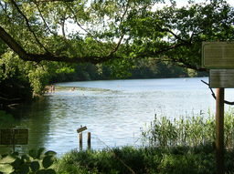
bei einem Blick auf die Karte konnten wir kurz einen neidischen Blick auf die einladene Wasserstelle an der Krummen Lanke werfen.
Point of interest after 15 km
ein guter Fahrradweg, aber ein Anstieg, der nie zu enden scheint. Deprimierend sind nur die Rennradfahrer, die auf der Straße an uns vorbei fuhren, als wäre es flach wie Holland. ;-(

Photo after 15.5 km
aber die Belohnung naht. Endlich am Grundewaldturm angekommen, können wir es uns dank der dortigen Bewirtschaftung mit Bedienung, sowie als Selbstbedienungsvariante so richtig gut hier gehen lassen. .................................... Auf einer Bank sitzend, können wir dann den Blick in die Ferne schweifen lassen.
Continue with Bikemap
Use, edit, or download this cycling route
You would like to ride Friedenau-Grunewaldturm-Friedenau or customize it for your own trip? Here is what you can do with this Bikemap route:
Free features
- Save this route as favorite or in collections
- Copy & plan your own version of this route
- Sync your route with Garmin or Wahoo
Premium features
Free trial for 3 days, or one-time payment. More about Bikemap Premium.
- Navigate this route on iOS & Android
- Export a GPX / KML file of this route
- Create your custom printout (try it for free)
- Download this route for offline navigation
Discover more Premium features.
Get Bikemap PremiumFrom our community
Other popular routes starting in Friedenau
 Friedenau - Friedenau(Havelchausse; 36 KM)
- Distance
- 36.4 km
- Ascent
- 151 m
- Descent
- 150 m
- Location
- Friedenau, State of Berlin, Germany
 S/U Bundesplatz - S Zehlendorf - Tremsdorf - Dobbrikow - Trebbin - Riesengroßbeuthen - Nudow - Drewitz - S Wannsee
- Distance
- 94.1 km
- Ascent
- 124 m
- Descent
- 124 m
- Location
- Friedenau, State of Berlin, Germany
 Dobbrikow kurz
- Distance
- 97.9 km
- Ascent
- 132 m
- Descent
- 131 m
- Location
- Friedenau, State of Berlin, Germany
 Friedenau-Grunewaldturm-Friedenau
- Distance
- 28.7 km
- Ascent
- 177 m
- Descent
- 174 m
- Location
- Friedenau, State of Berlin, Germany
 Friedenau-Trebbin
- Distance
- 85.5 km
- Ascent
- 88 m
- Descent
- 86 m
- Location
- Friedenau, State of Berlin, Germany
 Nachtfahrt Rennrad/Südwest
- Distance
- 26.9 km
- Ascent
- 70 m
- Descent
- 67 m
- Location
- Friedenau, State of Berlin, Germany
 Rund um den Wannsee via Außenweg
- Distance
- 67.9 km
- Ascent
- 222 m
- Descent
- 219 m
- Location
- Friedenau, State of Berlin, Germany
 Kleine Feierabendrunde im Grunewald
- Distance
- 37.1 km
- Ascent
- 151 m
- Descent
- 153 m
- Location
- Friedenau, State of Berlin, Germany
Open it in the app


